Earthquake Halmahera, Indonesia
Tue, 17 Feb 2026 16:00:58 GMT
Time17 hours ago
Location
2.1308, 128.0591
Depth
4.4 KM
Event Summary
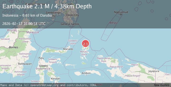
A 2.1 magnitude earthquake struck on Halmahera, Indonesia, at Tue, 17 Feb 2026 16:00:58 GMT. Depth: 4.377522km. Reviewed by BMKG seismologists, this minor quake occurred at a magnitude type of M.
Magnitude
2.1
M
Source
BMKG
Intensity
-
Agency Reports
1 Sources| Source | Magnitude | Depth | Time |
|---|---|---|---|
| BMKGPrimary | 2.1 | 4 km | 17 hours ago |
Earthquake Details
ManualEvent IDbmg2026djcj
Tsunami PotentialNo
Magnitude TypeM
Nearest Places
- Ake Mela Lamo2.5 km
- Desa Jere4.1 km
- Ake Jere4.3 km
- Tanjung Jere4.3 km
- Desa Jere Tua5.7 km
Comments
Join the discussion about this event.
Latest Earthquakes
2.4Mag
Central Alaska
Time17 hours ago
Depth176.64 km
SourceVYT (Automatic)
1.1Mag
13 km ENE of Cloverdale, CA
Time17 hours ago
Depth2.05 km
SourceUSGS (Automatic)
2.7Mag
Sumbawa region, Indonesia
Time17 hours ago
Depth134.16 km
SourceVYT (Automatic)
2.3Mag
Java, Indonesia
Time17 hours ago
Depth63.95 km
SourceBMKG
1.5Mag
Southern Alaska
Time17 hours ago
Depth67.26 km
SourceVYT (Automatic)
Nearby Earthquakes
2.9Mag
Halmahera, Indonesia
Time2 days ago
Depth0.00 km
SourceVYT (Automatic)
3.2Mag
Halmahera, Indonesia
Time2 weeks ago
Depth98.16 km
SourceBMKG (Automatic)
3.0Mag
HALMAHERA, INDONESIA
Time2 years ago
Depth10.00 km
SourceBMKG (Automatic)
3.0Mag
HALMAHERA, INDONESIA
Time4 months ago
Depth99.00 km
SourceBMKG (Automatic)
2.7Mag
HALMAHERA, INDONESIA
Time3 weeks ago
Depth65.00 km
SourceBMKG (Automatic)