Earthquake Southern Alaska
Tue, 17 Feb 2026 15:52:57 GMT
Time17 hours ago
Location
60.0446, -153.3010
Depth
67.3 KM
Event Summary
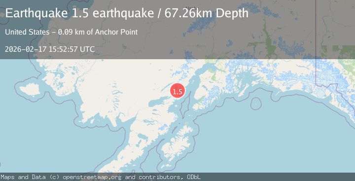
A 1.5 magnitude earthquake struck on Southern Alaska, at Tue, 17 Feb 2026 15:52:57 GMT. Depth: 67.2607421875km. Reviewed by VYT seismologists, this minor quake occurred at a magnitude type of earthquake.
Magnitude
1.5
earthquake
Source
VYT
Intensity
-
Agency Reports
1 Sources| Source | Magnitude | Depth | Time |
|---|---|---|---|
| VYTPrimary | 1.5 | 67 km | 17 hours ago |
Earthquake Details
AutomaticEvent IDvyt_138kkqaiylq0e
Tsunami PotentialNo
Magnitude Typeearthquake
Nearest Places
- Tongue Glacier5.3 km
- Umbrella Glacier9.6 km
- Roscoe Glacier10.8 km
- Iliamna Volcano11.9 km
- Holland Creek12.5 km
Comments
Join the discussion about this event.
Latest Earthquakes
2.4Mag
Northern Sumatra, Indonesia
Time17 hours ago
Depth8.31 km
SourceBMKG
1.2Mag
10 km NW of The Geysers, CA
Time17 hours ago
Depth1.41 km
SourceUSGS (Automatic)
1.0Mag
Southern Alaska
Time17 hours ago
Depth14.53 km
SourceVYT (Automatic)
3.5Mag
Kepulauan Mentawai region, Indonesia
Time17 hours ago
Depth29.42 km
SourceVYT (Automatic)
0.8Mag
30 km ESE of Lake Isabella, CA
Time17 hours ago
Depth6.21 km
SourceUSGS (Automatic)
Nearby Earthquakes
3.0Mag
SOUTHERN ALASKA
Time5 years ago
Depth137.00 km
SourceNEIC (Automatic)
3.0Mag
SOUTHERN ALASKA
Time5 years ago
Depth136.00 km
SourceNEIC (Automatic)
4.0Mag
SOUTHERN ALASKA
Time4 years ago
Depth130.00 km
SourceNEIC (Automatic)
3.0Mag
SOUTHERN ALASKA
Time8 months ago
Depth129.40 km
SourceAK (Automatic)
3.0Mag
SOUTHERN ALASKA
Time8 years ago
Depth124.00 km
SourceNEIC (Automatic)