Earthquake Southern Sumatra, Indonesia
Tue, 17 Feb 2026 21:47:11 GMT
Time11 hours ago
Location
-5.4734, 103.7268
Depth
36.7 KM
Event Summary
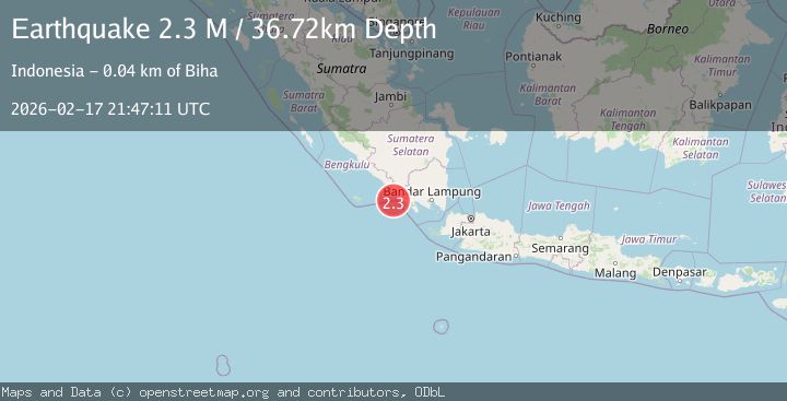
A 2.3 magnitude earthquake struck on Southern Sumatra, Indonesia, at Tue, 17 Feb 2026 21:47:11 GMT. Depth: 36.717606km. Reviewed by BMKG seismologists, this minor quake occurred at a magnitude type of M.
Magnitude
2.3
M
Source
BMKG
Intensity
-
Agency Reports
1 Sources| Source | Magnitude | Depth | Time |
|---|---|---|---|
| BMKGPrimary | 2.3 | 37 km | 11 hours ago |
Earthquake Details
ManualEvent IDbmg2026djnt
Tsunami PotentialNo
Magnitude TypeM
Nearest Places
- Padangnegeri34.5 km
- Ujung Walor34.5 km
- Desa Suka Jadi34.6 km
- Lintik34.6 km
- Ujung Tapokan34.6 km
Comments
Join the discussion about this event.
Latest Earthquakes
1.4Mag
Kenai Peninsula, Alaska
Time11 hours ago
Depth35.28 km
SourceVYT (Automatic)
2.6Mag
Java, Indonesia
Time11 hours ago
Depth62.13 km
SourceBMKG
1.8Mag
Tarapaca, Chile
Time11 hours ago
Depth0.00 km
SourceVYT (Automatic)
1.6Mag
Southeastern Alaska
Time11 hours ago
Depth0.00 km
SourceVYT (Automatic)
2.1Mag
Southern Sumatra, Indonesia
Time11 hours ago
Depth38.27 km
SourceBMKG
Nearby Earthquakes
2.7Mag
Southern Sumatra, Indonesia
Time3 weeks ago
Depth27.97 km
SourceBMKG (Automatic)
2.3Mag
Southern Sumatra, Indonesia
Time2 weeks ago
Depth13.05 km
SourceBMKG (Automatic)
3.0Mag
SOUTHERN SUMATRA, INDONESIA
Time8 months ago
Depth28.00 km
SourceBMKG (Automatic)
3.0Mag
SOUTHERN SUMATRA, INDONESIA
Time3 years ago
Depth26.00 km
SourceDJA (Automatic)
3.0Mag
SOUTHERN SUMATRA, INDONESIA
Time3 years ago
Depth30.00 km
SourceDJA (Automatic)