Earthquake Southern Sumatra, Indonesia
Tue, 17 Feb 2026 21:36:39 GMT
Time14 hours ago
Location
-5.6563, 104.1657
Depth
38.3 KM
Event Summary
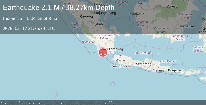
A 2.1 magnitude earthquake struck on Southern Sumatra, Indonesia, at Tue, 17 Feb 2026 21:36:39 GMT. Depth: 38.26939km. Reviewed by BMKG seismologists, this minor quake occurred at a magnitude type of M.
Magnitude
2.1
M
Source
BMKG
Intensity
-
Agency Reports
1 Sources| Source | Magnitude | Depth | Time |
|---|---|---|---|
| BMKGPrimary | 2.1 | 38 km | 14 hours ago |
Earthquake Details
ManualEvent IDbmg2026djnk
Tsunami PotentialNo
Magnitude TypeM
Nearest Places
- Ujung Siging14.8 km
- Cukuh Batuberagam15.3 km
- Labuan Siging16.0 km
- Teluk Bengkunat16.2 km
- Wai Baru16.3 km
Comments
Join the discussion about this event.
Latest Earthquakes
1.6Mag
Southeastern Alaska
Time14 hours ago
Depth0.00 km
SourceVYT (Automatic)
2.3Mag
Flores Sea
Time14 hours ago
Depth36.30 km
SourceBMKG
2.4Mag
Bali Region, Indonesia
Time14 hours ago
Depth10.00 km
SourceBMKG
3.0Mag
Tarapaca, Chile
Time14 hours ago
Depth100.83 km
SourceVYT (Automatic)
2.1Mag
Sumbawa Region, Indonesia
Time14 hours ago
Depth10.00 km
SourceBMKG
Nearby Earthquakes
5.1Mag
SOUTHERN SUMATRA, INDONESIA
Time11 years ago
Depth84.00 km
SourceEMSC (Automatic)
3.0Mag
SOUTHERN SUMATRA, INDONESIA
Time3 years ago
Depth10.00 km
SourceDJA (Automatic)
5.5Mag
SOUTHERN SUMATRA, INDONESIA
Time20 years ago
Depth2.00 km
SourceEMSC (Automatic)
2.4Mag
Southern Sumatra, Indonesia
Time3 days ago
Depth1.47 km
SourceBMKG
3.0Mag
Southern Sumatra, Indonesia
Time2 weeks ago
Depth5.00 km
SourceBMKG (Automatic)