Earthquake Northern Sumatra, Indonesia
Wed, 18 Feb 2026 09:30:16 GMT
Time4 hours ago
Location
4.1494, 97.4472
Depth
1.0 KM
Event Summary
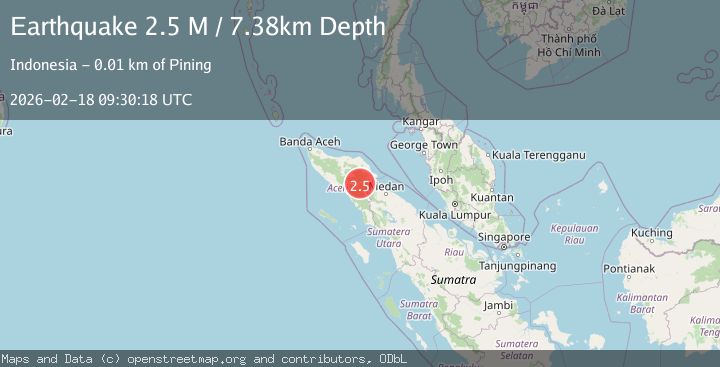
A 2.4 magnitude earthquake struck on Northern Sumatra, Indonesia, at Wed, 18 Feb 2026 09:30:16 GMT. Depth: 1km. Reviewed by BMKG seismologists, this minor quake occurred at a magnitude type of M.
Magnitude
2.4
M
Source
BMKG
Intensity
-
Agency Reports
1 Sources| Source | Magnitude | Depth | Time |
|---|---|---|---|
| BMKGPrimary | 2.4 | 1 km | 4 hours ago |
Earthquake Details
ManualEvent IDbmg2026dkky
Tsunami PotentialNo
Magnitude TypeM
Nearest Places
- Gunung Aber2.7 km
- Burni Siluman3.2 km
- Gunung Lojang3.9 km
- Burni Apitan4.4 km
- Burni Pepelar5.1 km
Comments
Join the discussion about this event.
Latest Earthquakes
1.4Mag
Tarapaca, Chile
Time4 hours ago
Depth0.00 km
SourceVYT (Automatic)
2.1Mag
Sweden
Time4 hours ago
Depth7.08 km
SourceVYT (Automatic)
2.3Mag
Alaska Peninsula
Time4 hours ago
Depth113.04 km
SourceVYT (Automatic)
2.2Mag
Northern Sumatra, Indonesia
Time4 hours ago
Depth6.04 km
SourceBMKG
2.6Mag
Java, Indonesia
Time4 hours ago
Depth16.25 km
SourceBMKG
Nearby Earthquakes
3.0Mag
NORTHERN SUMATRA, INDONESIA
Time0 months ago
Depth3.00 km
SourceBMKG (Automatic)
2.6Mag
Northern Sumatra, Indonesia
Time2 weeks ago
Depth5.00 km
SourceBMKG (Automatic)
3.2Mag
Northern Sumatra, Indonesia
Time3 days ago
Depth3.00 km
SourceBMKG
3.0Mag
NORTHERN SUMATRA, INDONESIA
Time5 months ago
Depth5.00 km
SourceBMKG (Automatic)
2.6Mag
Northern Sumatra, Indonesia
Time2 weeks ago
Depth1.11 km
SourceBMKG (Automatic)