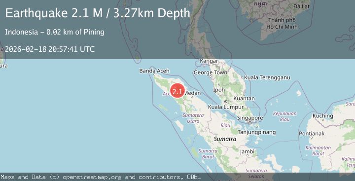
Earthquake Northern Sumatra, Indonesia
Wed, 18 Feb 2026 20:57:41 GMT
Time5 hours ago
Location
4.1621, 97.4188
Depth
3.3 KM
Event Summary
A 2.1 magnitude earthquake struck on Northern Sumatra, Indonesia, at Wed, 18 Feb 2026 20:57:41 GMT. Depth: 3.265346km. Reviewed by BMKG seismologists, this minor quake occurred at a magnitude type of M.
Magnitude
2.1
M
Source
BMKG
Intensity
-
Agency Reports
1 Sources| Source | Magnitude | Depth | Time |
|---|---|---|---|
| BMKGPrimary | 2.1 | 3 km | 5 hours ago |
Earthquake Details
ManualEvent IDbmg2026dlhq
Tsunami PotentialNo
Magnitude TypeM
Nearest Places
- Burni Siluman1.1 km
- Burni Pepelar1.8 km
- Burni Apitan3.0 km
- Gunung Lojang3.1 km
- Gunung Aber3.8 km
Comments
Join the discussion about this event.
Latest Earthquakes
1.1Mag
Gaspe Peninsula, Quebec, Canada
Time5 hours ago
Depth0.00 km
SourceVYT (Automatic)
0.7Mag
Southern Alaska
Time5 hours ago
Depth0.00 km
SourceVYT (Automatic)
2.2Mag
Tarapaca, Chile
Time5 hours ago
Depth0.12 km
SourceVYT (Automatic)
3.7Mag
Adriatic Sea
Time5 hours ago
Depth10.00 km
SourceVYT (Automatic)
1.2Mag
4 km W of Lake Henshaw, CA
Time5 hours ago
Depth12.20 km
SourceUSGS (Automatic)
Nearby Earthquakes
2.9Mag
Northern Sumatra, Indonesia
Time1 week ago
Depth1.00 km
SourceBMKG (Automatic)
2.9Mag
Northern Sumatra, Indonesia
Time1 week ago
Depth3.00 km
SourceBMKG (Automatic)
2.1Mag
Northern Sumatra, Indonesia
Time2 weeks ago
Depth2.00 km
SourceBMKG (Automatic)
2.2Mag
Northern Sumatra, Indonesia
Time2 days ago
Depth5.00 km
SourceBMKG
2.8Mag
Northern Sumatra, Indonesia
Time5 days ago
Depth0.00 km
SourceBMKG