Earthquake Near North Coast of West Papua
Mon, 23 Feb 2026 05:43:55 GMT
Time3 hours ago
Location
-2.2485, 140.1581
Depth
10.0 KM
Event Summary
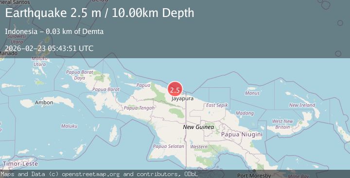
A 2.3 magnitude earthquake struck on Near North Coast of West Papua, at Mon, 23 Feb 2026 05:43:55 GMT. Depth: 10km. Reviewed by BMKG seismologists, this minor quake occurred at a magnitude type of M.
Magnitude
2.3
M
Source
BMKG
Intensity
-
Agency Reports
1 Sources| Source | Magnitude | Depth | Time |
|---|---|---|---|
| BMKGPrimary | 2.3 | 10 km | 3 hours ago |
Earthquake Details
ManualEvent IDbmg2026dtha
Tsunami PotentialNo
Magnitude TypeM
Nearest Places
- 8.5 km
- 8.6 km
- 9.3 km
- 9.5 km
- 9.7 km
Comments
Join the discussion about this event.
Latest Earthquakes
2.6Mag
Fox Islands, Aleutian Islands, Alaska
Time3 hours ago
Depth0.00 km
SourceVYT (Automatic)
1.9Mag
47 km ESE of Alamo, Nevada
Time3 hours ago
Depth15.49 km
SourceUSGS (Automatic)
4.3Mag
Channel Islands region, California
Time3 hours ago
Depth8.91 km
SourceVYT (Automatic)
2.2Mag
Southern Alaska
Time3 hours ago
Depth78.25 km
SourceVYT (Automatic)
1.5Mag
WESTERN TURKEY
Time3 hours ago
Depth9.50 km
SourceAFAD (Automatic)
Nearby Earthquakes
2.8Mag
NEAR N COAST OF PAPUA, INDONESIA
Time1 month ago
Depth10.00 km
SourceBMKG (Automatic)
2.2Mag
Near North Coast of West Papua
Time3 weeks ago
Depth4.12 km
SourceBMKG (Automatic)
2.7Mag
Near North Coast of West Papua
Time23 hours ago
Depth17.60 km
SourceBMKG
2.2Mag
Near North Coast of West Papua
Time2 weeks ago
Depth10.00 km
SourceBMKG (Automatic)
2.1Mag
Near North Coast of West Papua
Time1 week ago
Depth10.00 km
SourceBMKG