Earthquake Near North Coast of West Papua
Fri, 06 Feb 2026 16:11:19 GMT
Time1 hour ago
Location
-2.2377, 140.1134
Depth
10.0 KM
Event Summary
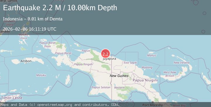
A 2.2 magnitude earthquake struck on Near North Coast of West Papua, at Fri, 06 Feb 2026 16:11:19 GMT. Depth: 10km. Reviewed by BMKG seismologists, this minor quake occurred at a magnitude type of M.
Magnitude
2.2
M
Source
BMKG
Intensity
-
Agency Reports
1 Sources| Source | Magnitude | Depth | Time |
|---|---|---|---|
| BMKGPrimary | 2.2 | 10 km | 1 hour ago |
Earthquake Details
AutomaticEvent IDbmg2026cpad
Tsunami PotentialNo
Magnitude TypeM
Nearest Places
- Tarfia7.1 km
- Tanjung Kamadara9.2 km
- Tanjung Korongwan10.1 km
- Teluk Matterer10.6 km
- Pulau Besar11.4 km
Comments
Join the discussion about this event.
Latest Earthquakes
1.1Mag
8 km W of Cobb, CA
Time9 minutes ago
Depth1.47 km
SourceUSGS (Automatic)
3.7Mag
CRETE, GREECE
Time12 minutes ago
Depth2.40 km
SourceEMSC (Automatic)
2.6Mag
Flores Region, Indonesia
Time14 minutes ago
Depth169.17 km
SourceBMKG (Automatic)
1.2Mag
56 km E of McCarthy, Alaska
Time15 minutes ago
Depth5.00 km
SourceUSGS (Automatic)
1.5Mag
NORTHERN ITALY
Time20 minutes ago
Depth10.40 km
SourceETHZ (Automatic)
Nearby Earthquakes
3.2Mag
Near North Coast of West Papua
Time1 week ago
Depth10.00 km
SourceBMKG (Automatic)
2.8Mag
Near North Coast of West Papua
Time2 days ago
Depth10.00 km
SourceBMKG (Automatic)
2.2Mag
Near North Coast of West Papua
Time1 week ago
Depth4.12 km
SourceBMKG (Automatic)
2.6Mag
Near North Coast of West Papua
Time1 week ago
Depth18.57 km
SourceBMKG (Automatic)
2.4Mag
Near North Coast of West Papua
Time2 weeks ago
Depth18.12 km
SourceBMKG (Automatic)