Earthquake Near North Coast of West Papua
Fri, 27 Feb 2026 08:28:54 GMT
Time1 hour ago
Location
-2.8822, 140.6434
Depth
10.0 KM
Event Summary
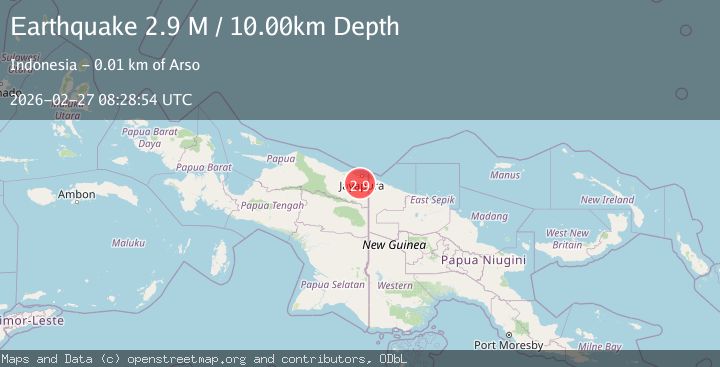
A 2.9 magnitude earthquake struck on Near North Coast of West Papua, at Fri, 27 Feb 2026 08:28:54 GMT. Depth: 10km. Reviewed by BMKG seismologists, this minor quake occurred at a magnitude type of M.
Magnitude
2.9
M
Source
BMKG
Intensity
-
Agency Reports
1 Sources| Source | Magnitude | Depth | Time |
|---|---|---|---|
| BMKGPrimary | 2.9 | 10 km | 1 hour ago |
Earthquake Details
ManualEvent IDbmg2026eaum
Tsunami PotentialNo
Magnitude TypeM
Nearest Places
- 1.4 km
- 1.7 km
- 2.1 km
- 3.8 km
- 4.0 km
Comments
Join the discussion about this event.
Latest Earthquakes
0.8Mag
8 km NW of The Geysers, CA
Time1 hour ago
Depth1.37 km
SourceUSGS (Automatic)
0.8Mag
7 km WSW of Anza, CA
Time1 hour ago
Depth3.90 km
SourceUSGS (Automatic)
2.8Mag
OKLAHOMA
Time1 hour ago
Depth2.60 km
SourceOK (Automatic)
3.0Mag
Timor Region
Time1 hour ago
Depth28.85 km
SourceBMKG
1.5Mag
Washington
Time1 hour ago
Depth34.18 km
SourceVYT (Automatic)
Nearby Earthquakes
2.3Mag
Near North Coast of West Papua
Time1 month ago
Depth10.00 km
SourceBMKG (Automatic)
2.5Mag
Near North Coast of West Papua
Time1 week ago
Depth20.91 km
SourceBMKG
2.5Mag
Near North Coast of West Papua
Time1 week ago
Depth25.68 km
SourceBMKG
3.0Mag
NEAR N COAST OF PAPUA, INDONESIA
Time2 years ago
Depth10.00 km
SourceBMKG (Automatic)
3.6Mag
NEAR N COAST OF PAPUA, INDONESIA
Time1 month ago
Depth10.00 km
SourceBMKG (Automatic)