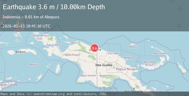
Earthquake NEAR N COAST OF PAPUA, INDONESIA
Tue, 13 Jan 2026 10:45:30 GMT
Time1 month ago
Location
-2.7100, 140.6100
Depth
10.0 KM
Event Summary
A 3.6 magnitude earthquake struck on NEAR N COAST OF PAPUA, INDONESIA, at Tue, 13 Jan 2026 10:45:30 GMT. Depth: 10km. Reviewed by BMKG seismologists, this minor quake occurred at a magnitude type of m.
Magnitude
3.6
m
Source
BMKG
Intensity
-
Agency Reports
1 Sources| Source | Magnitude | Depth | Time |
|---|---|---|---|
| BMKGPrimary | 3.6 | 10 km | 1 month ago |
Earthquake Details
AutomaticEvent IDemsc_BMKG_20260113_0000147
Tsunami PotentialNo
Magnitude Typem
Nearest Places
- Pue3.2 km
- Kampung Yokiwa3.4 km
- Kampung Puai3.6 km
- Kampung Alang-Alang Raya4.1 km
- Kelurahan Asano6.3 km
Comments
Join the discussion about this event.
Latest Earthquakes
3.9Mag
Flores region, Indonesia
Time17 hours ago
Depth176.39 km
SourceVYT (Automatic)
3.0Mag
near the coast of southern Peru
Time17 hours ago
Depth57.25 km
SourceVYT (Automatic)
1.5Mag
42 km NW of Toyah, Texas
Time18 hours ago
Depth4.28 km
SourceUSGS (Automatic)
2.1Mag
Antofagasta, Chile
Time18 hours ago
Depth60.55 km
SourceVYT (Automatic)
2.6Mag
Central Alaska
Time18 hours ago
Depth0.00 km
SourceVYT (Automatic)
Nearby Earthquakes
2.5Mag
Near North Coast of West Papua
Time4 days ago
Depth25.68 km
SourceBMKG
2.3Mag
Near North Coast of West Papua
Time3 weeks ago
Depth10.00 km
SourceBMKG (Automatic)
3.2Mag
NEAR N COAST OF PAPUA, INDONESIA
Time1 month ago
Depth12.00 km
SourceBMKG (Automatic)
3.0Mag
NEAR N COAST OF PAPUA, INDONESIA
Time8 years ago
Depth10.00 km
SourceDJA (Automatic)
2.3Mag
Near North Coast of West Papua
Time5 days ago
Depth10.00 km
SourceBMKG