Earthquake WESTERN TEXAS
Fri, 16 Jan 2026 05:11:06 GMT
Time3 hours ago
Location
31.5290, -104.0220
Depth
5.9 KM
Event Summary
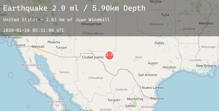
A 2.0 magnitude earthquake struck on WESTERN TEXAS, at Fri, 16 Jan 2026 05:11:06 GMT. Depth: 5.9km. Reviewed by TX seismologists, this minor quake occurred at a magnitude type of ml.
Magnitude
2.0
ml
Source
TX
Intensity
-
Agency Reports
2 Sources| Source | Magnitude | Depth | Time |
|---|---|---|---|
| TXPrimary | 2.0 | 6 km | 3 hours ago |
| USGS | 2.0 | 6 km | 3 hours ago |
Earthquake Details
AutomaticEvent IDemsc_20260116_0000074
Tsunami PotentialNo
Magnitude Typeml
Nearest Places
- Juan Windmill2.3 km
- Dry Lake3.3 km
- Dutch Draw5.2 km
- Lynn Tank6.3 km
- Rabbit Tank7.7 km
Comments
Join the discussion about this event.
Latest Earthquakes
4.3Mag
ANTOFAGASTA, CHILE
Time4 hours ago
Depth253.20 km
SourceCSN (Automatic)
1.3Mag
2 km NW of The Geysers, CA
Time4 hours ago
Depth1.84 km
SourceUSGS (Automatic)
2.8Mag
MEGHALAYA, INDIA REGION
Time4 hours ago
Depth10.00 km
SourceNDI (Automatic)
3.5Mag
ANTOFAGASTA, CHILE
Time4 hours ago
Depth125.50 km
SourceCSN (Automatic)
2.2Mag
DODECANESE IS.-TURKEY BORDER REG
Time4 hours ago
Depth17.00 km
SourceEMSC (Automatic)
Nearby Earthquakes
2.0Mag
WESTERN TEXAS
Time5 hours ago
Depth4.70 km
SourceTX (Automatic)
3.1Mag
30 km NW of Toyah, Texas
Time7 hours ago
Depth4.50 km
SourceUSGS (Automatic)
2.0Mag
30 km NW of Toyah, Texas
Time9 hours ago
Depth4.75 km
SourceUSGS (Automatic)
1.8Mag
42 km NW of Toyah, Texas
Time12 hours ago
Depth4.49 km
SourceUSGS (Automatic)
2.3Mag
WESTERN TEXAS
Time13 hours ago
Depth4.20 km
SourceTX (Automatic)