Earthquake SOUTHERN SUMATRA, INDONESIA
Mon, 12 Jan 2026 01:13:38 GMT
Time1 month ago
Location
-4.6100, 102.8400
Depth
47.0 KM
Event Summary
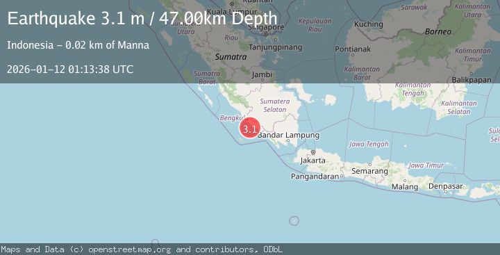
A 3.1 magnitude earthquake struck on SOUTHERN SUMATRA, INDONESIA, at Mon, 12 Jan 2026 01:13:38 GMT. Depth: 47km. Reviewed by BMKG seismologists, this minor quake occurred at a magnitude type of m.
Magnitude
3.1
m
Source
BMKG
Intensity
-
Agency Reports
1 Sources| Source | Magnitude | Depth | Time |
|---|---|---|---|
| BMKGPrimary | 3.1 | 47 km | 1 month ago |
Earthquake Details
AutomaticEvent IDemsc_BMKG_20260112_0000013
Tsunami PotentialNo
Magnitude Typem
Nearest Places
- Air Manna15.2 km
- Tanjung Manna15.6 km
- Tegrulung15.7 km
- Desa Ketaping15.8 km
- Desa Manggul16.0 km
Comments
Join the discussion about this event.
Latest Earthquakes
1.7Mag
Alaska Peninsula
Time3 minutes ago
Depth0.00 km
SourceVYT (Automatic)
1.4Mag
Kenai Peninsula, Alaska
Time6 minutes ago
Depth1.95 km
SourceVYT (Automatic)
3.1Mag
Northern Sumatra, Indonesia
Time7 minutes ago
Depth14.69 km
SourceBMKG
1.9Mag
Channel Islands region, California
Time7 minutes ago
Depth2.81 km
SourceVYT (Automatic)
3.3Mag
Southern Alaska
Time14 minutes ago
Depth13.06 km
SourceVYT (Automatic)
Nearby Earthquakes
5.3Mag
SOUTHERN SUMATRA, INDONESIA
Time15 years ago
Depth69.00 km
SourceEMSC (Automatic)
5.3Mag
SOUTHERN SUMATRA, INDONESIA
Time7 years ago
Depth68.00 km
SourceEMSC (Automatic)
2.9Mag
SOUTHERN SUMATRA, INDONESIA
Time2 weeks ago
Depth45.00 km
SourceBMKG (Automatic)
3.0Mag
SOUTHERN SUMATRA, INDONESIA
Time3 years ago
Depth39.00 km
SourceDJA (Automatic)
3.0Mag
SOUTHERN SUMATRA, INDONESIA
Time2 months ago
Depth60.00 km
SourceBMKG (Automatic)