Earthquake KEPULAUAN BABAR, INDONESIA
Fri, 16 Jan 2026 04:34:08 GMT
Time1 month ago
Location
-7.0400, 129.7300
Depth
172.0 KM
Event Summary
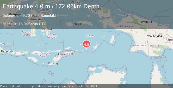
A 4.0 magnitude earthquake struck on KEPULAUAN BABAR, INDONESIA, at Fri, 16 Jan 2026 04:34:08 GMT. Depth: 172km. Reviewed by BMKG seismologists, this light quake occurred at a magnitude type of m.
Magnitude
4.0
m
Source
BMKG
Intensity
-
Agency Reports
1 Sources| Source | Magnitude | Depth | Time |
|---|---|---|---|
| BMKGPrimary | 4.0 | 172 km | 1 month ago |
Earthquake Details
AutomaticEvent IDemsc_BMKG_20260116_0000064
Tsunami PotentialNo
Magnitude Typem
Nearest Places
- Damar Ridge34.2 km
- Tanjung Sifanandrierna39.3 km
- Wotai40.4 km
- Rumadai41.1 km
- Bumai41.2 km
Comments
Join the discussion about this event.
Latest Earthquakes
3.7Mag
Southern Alaska
Time8 minutes ago
Depth9.77 km
SourceVYT (Automatic)
1.3Mag
7 km NE of Coso Junction, CA
Time11 minutes ago
Depth5.86 km
SourceUSGS (Automatic)
2.2Mag
CENTRAL TURKEY
Time13 minutes ago
Depth5.00 km
SourceKOERI (Automatic)
1.1Mag
31 km WSW of Ackerly, Texas
Time17 minutes ago
Depth3.93 km
SourceUSGS (Automatic)
2.4Mag
West Papua Region, Indonesia
Time25 minutes ago
Depth10.00 km
SourceBMKG
Nearby Earthquakes
3.7Mag
KEPULAUAN BABAR, INDONESIA
Time1 month ago
Depth174.00 km
SourceBMKG (Automatic)
3.8Mag
KEPULAUAN BABAR, INDONESIA
Time0 months ago
Depth191.00 km
SourceBMKG (Automatic)
4.5Mag
Banda Sea
Time2 days ago
Depth71.53 km
SourceVYT (Automatic)
5.6Mag
KEPULAUAN BABAR, INDONESIA
Time2 years ago
Depth120.00 km
SourceEMSC (Automatic)
5.9Mag
Banda Sea
Time0 months ago
Depth102.35 km
SourceBMKG (Automatic)