Earthquake TIMOR REGION, INDONESIA
Wed, 21 Jan 2026 02:43:10 GMT
Time0 months ago
Location
-10.9500, 123.8300
Depth
117.0 KM
Event Summary
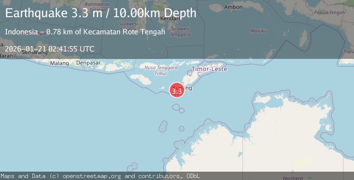
A 3.3 magnitude earthquake struck on TIMOR REGION, INDONESIA, at Wed, 21 Jan 2026 02:43:10 GMT. Depth: 117km. Reviewed by BMKG seismologists, this minor quake occurred at a magnitude type of m.
Magnitude
3.3
m
Source
BMKG
Intensity
-
Agency Reports
1 Sources| Source | Magnitude | Depth | Time |
|---|---|---|---|
| BMKGPrimary | 3.3 | 10 km | 0 months ago |
Earthquake Details
AutomaticEvent IDemsc_BMKG_20260121_0000047
Tsunami PotentialNo
Magnitude Typem
Nearest Places
- Beatrice Reefs54.3 km
- Tanjung Pule55.0 km
- Tanjung Rodi55.2 km
- Tanjung Roadale55.5 km
- Teluk Oesosole55.6 km
Comments
Join the discussion about this event.
Latest Earthquakes
2.8Mag
Sunda Strait, Indonesia
Time7 minutes ago
Depth3.61 km
SourceBMKG
3.6Mag
south of Alaska
Time8 minutes ago
Depth10.00 km
SourceVYT (Automatic)
1.2Mag
Central Alaska
Time10 minutes ago
Depth68.97 km
SourceVYT (Automatic)
1.2Mag
Washington
Time12 minutes ago
Depth0.00 km
SourceVYT (Automatic)
0.8Mag
10 km WNW of The Geysers, CA
Time18 minutes ago
Depth1.96 km
SourceUSGS (Automatic)
Nearby Earthquakes
4.1Mag
Timor region, Indonesia
Time6 days ago
Depth0.00 km
SourceVYT (Automatic)
3.1Mag
Timor Region
Time1 week ago
Depth40.74 km
SourceBMKG (Automatic)
3.4Mag
TIMOR REGION, INDONESIA
Time1 month ago
Depth59.00 km
SourceBMKG (Automatic)
3.0Mag
TIMOR REGION, INDONESIA
Time3 months ago
Depth92.00 km
SourceBMKG (Automatic)
3.1Mag
TIMOR REGION, INDONESIA
Time1 month ago
Depth14.00 km
SourceBMKG (Automatic)