Earthquake NEAR S COAST OF PAPUA, INDONESIA
Thu, 22 Jan 2026 18:29:54 GMT
Time4 days ago
Location
-4.5200, 133.9200
Depth
54.0 KM
Event Summary
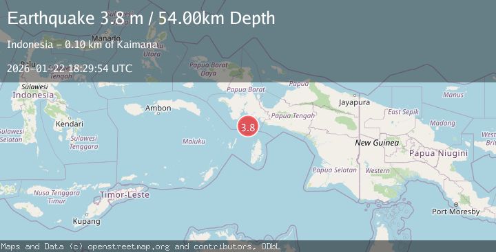
A 3.8 magnitude earthquake struck on NEAR S COAST OF PAPUA, INDONESIA, at Thu, 22 Jan 2026 18:29:54 GMT. Depth: 54km. Reviewed by BMKG seismologists, this minor quake occurred at a magnitude type of m.
Magnitude
3.8
m
Source
BMKG
Intensity
-
Agency Reports
1 Sources| Source | Magnitude | Depth | Time |
|---|---|---|---|
| BMKGPrimary | 3.8 | 54 km | 4 days ago |
Earthquake Details
AutomaticEvent IDemsc_BMKG_20260122_0000342
Tsunami PotentialNo
Magnitude Typem
Nearest Places
- Tanjung Watukebo45.3 km
- Pulau Tumbutumbu50.8 km
- Aru Basin54.1 km
- Kampung Adi Jaya59.4 km
- Manggawitu62.6 km
Comments
Join the discussion about this event.
Latest Earthquakes
3.7Mag
VALPARAISO, CHILE
Time7 minutes ago
Depth27.60 km
SourceCSN (Automatic)
2.0Mag
CENTRAL TURKEY
Time9 minutes ago
Depth23.50 km
SourceKOERI (Automatic)
3.2Mag
OFFSHORE EL SALVADOR
Time11 minutes ago
Depth28.00 km
SourceINET (Automatic)
3.1Mag
South of Java, Indonesia
Time11 minutes ago
Depth5.01 km
SourceBMKG (Automatic)
2.2Mag
Near North Coast of West Papua
Time14 minutes ago
Depth10.00 km
SourceBMKG (Automatic)
Nearby Earthquakes
2.9Mag
West Papua Region, Indonesia
Time2 days ago
Depth10.00 km
SourceBMKG (Automatic)
3.9Mag
Aru Islands Region, Indonesia
Time2 days ago
Depth32.89 km
SourceBMKG (Automatic)
3.1Mag
West Papua Region, Indonesia
Time3 days ago
Depth10.00 km
SourceBMKG (Automatic)
3.0Mag
West Papua Region, Indonesia
Time4 days ago
Depth13.42 km
SourceBMKG (Automatic)
2.9Mag
West Papua Region, Indonesia
Time1 day ago
Depth10.68 km
SourceBMKG (Automatic)