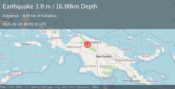
Earthquake PAPUA, INDONESIA
Thu, 05 Feb 2026 06:59:36 GMT
Time3 hours ago
Location
-3.4000, 139.2400
Depth
16.0 KM
Event Summary
A 3.0 magnitude earthquake struck on PAPUA, INDONESIA, at Thu, 05 Feb 2026 06:59:36 GMT. Depth: 16km. Reviewed by BMKG seismologists, this minor quake occurred at a magnitude type of m.
Magnitude
3.0
m
Source
BMKG
Intensity
-
Agency Reports
1 Sources| Source | Magnitude | Depth | Time |
|---|---|---|---|
| BMKGPrimary | 3.0 | 16 km | 3 hours ago |
Earthquake Details
AutomaticEvent IDemsc_BMKG_20260205_0000106
Tsunami PotentialNo
Magnitude Typem
Nearest Places
- Bernhard Camp13.8 km
- Kampung Megambilis16.9 km
- Distrik Megambilis17.7 km
- Osuavlakka19.2 km
- Kampung Homasan21.8 km
Comments
Join the discussion about this event.
Latest Earthquakes
0.8Mag
8 km W of Cobb, CA
Time3 hours ago
Depth1.89 km
SourceUSGS (Automatic)
1.4Mag
13 km N of Borrego Springs, CA
Time3 hours ago
Depth10.87 km
SourceUSGS (Automatic)
2.6Mag
Northern Sumatra, Indonesia
Time3 hours ago
Depth138.44 km
SourceBMKG (Automatic)
0.7Mag
3 km NW of Loma Linda, CA
Time3 hours ago
Depth3.98 km
SourceUSGS (Automatic)
3.0Mag
West Papua Region, Indonesia
Time3 hours ago
Depth12.90 km
SourceBMKG (Automatic)
Nearby Earthquakes
2.7Mag
PAPUA, INDONESIA
Time1 week ago
Depth10.00 km
SourceBMKG (Automatic)
3.5Mag
Near North Coast of West Papua
Time1 week ago
Depth67.58 km
SourceBMKG (Automatic)
2.2Mag
Near North Coast of West Papua
Time5 days ago
Depth76.71 km
SourceBMKG (Automatic)
3.5Mag
Near North Coast of West Papua
Time1 week ago
Depth9.75 km
SourceBMKG (Automatic)
2.8Mag
Near North Coast of West Papua
Time9 hours ago
Depth10.00 km
SourceBMKG (Automatic)