Earthquake SOUTHERN SUMATRA, INDONESIA
Sat, 07 Feb 2026 05:16:29 GMT
Time3 days ago
Location
-2.9200, 102.9200
Depth
58.0 KM
Event Summary
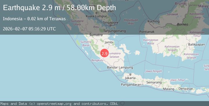
A 2.9 magnitude earthquake struck on SOUTHERN SUMATRA, INDONESIA, at Sat, 07 Feb 2026 05:16:29 GMT. Depth: 58km. Reviewed by BMKG seismologists, this minor quake occurred at a magnitude type of m.
Magnitude
2.9
m
Source
BMKG
Intensity
-
Agency Reports
1 Sources| Source | Magnitude | Depth | Time |
|---|---|---|---|
| BMKGPrimary | 2.9 | 58 km | 3 days ago |
Earthquake Details
AutomaticEvent IDemsc_BMKG_20260207_0000080
Tsunami PotentialNo
Magnitude Typem
Nearest Places
- Desa Mekar Sari1.6 km
- Desa Karya Mulia4.0 km
- Sungai Jawa4.4 km
- Desa Embacang Baru Ilir4.4 km
- Sungai Buah4.4 km
Comments
Join the discussion about this event.
Latest Earthquakes
2.4Mag
southern Sumatra, Indonesia
Time3 hours ago
Depth0.00 km
SourceVYT (Automatic)
2.4Mag
Java, Indonesia
Time3 hours ago
Depth53.60 km
SourceBMKG
2.2Mag
Alaska Peninsula
Time3 hours ago
Depth27.95 km
SourceVYT (Automatic)
1.0Mag
Pyrenees
Time3 hours ago
Depth0.00 km
SourceVYT (Automatic)
1.9Mag
9 km NE of Pāhala, Hawaii
Time3 hours ago
Depth32.44 km
SourceUSGS (Automatic)
Nearby Earthquakes
3.4Mag
southern Sumatra, Indonesia
Time3 hours ago
Depth0.12 km
SourceVYT (Automatic)
3.0Mag
Southern Sumatra, Indonesia
Time2 days ago
Depth124.36 km
SourceBMKG (Automatic)
2.4Mag
southern Sumatra, Indonesia
Time3 hours ago
Depth0.00 km
SourceVYT (Automatic)
5.0Mag
Southern Sumatra, Indonesia
Time1 week ago
Depth233.46 km
SourceBMKG (Automatic)
2.7Mag
Southern Sumatra, Indonesia
Time2 weeks ago
Depth129.75 km
SourceBMKG (Automatic)