Earthquake KEPULAUAN KAI, INDONESIA
Thu, 09 Feb 2006 05:44:24 GMT
Time20 years ago
Location
-5.2000, 133.1000
Depth
10.0 KM
Event Summary
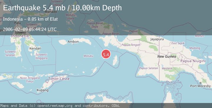
A 5.4 magnitude earthquake struck on KEPULAUAN KAI, INDONESIA, at Thu, 09 Feb 2006 05:44:24 GMT. Depth: 10km. Reviewed by EMSC seismologists, this moderate quake occurred at a magnitude type of mb.
Magnitude
5.4
mb
Source
EMSC
Intensity
-
Agency Reports
1 Sources| Source | Magnitude | Depth | Time |
|---|---|---|---|
| EMSCPrimary | 5.4 | 10 km | 20 years ago |
Earthquake Details
AutomaticEvent IDemsc_EMSC_20060209_0000039
Tsunami PotentialNo
Magnitude Typemb
Nearest Places
- Tanjung Patingru9.3 km
- Niv9.3 km
- Teluk Wair9.9 km
- Tanjung Borang10.0 km
- Desa Waerat10.7 km
Comments
Join the discussion about this event.
Latest Earthquakes
2.4Mag
Finland-Russia border region
Time2 minutes ago
Depth341.92 km
SourceVYT (Automatic)
0.9Mag
8 km W of Cobb, CA
Time6 minutes ago
Depth1.53 km
SourceUSGS (Automatic)
1.8Mag
Central Alaska
Time9 minutes ago
Depth2.08 km
SourceVYT (Automatic)
2.9Mag
WESTERN TURKEY
Time12 minutes ago
Depth11.80 km
SourceKOERI (Automatic)
2.8Mag
Sulawesi, Indonesia
Time13 minutes ago
Depth21.08 km
SourceBMKG
Nearby Earthquakes
4.0Mag
Aru Islands Region, Indonesia
Time1 day ago
Depth8.89 km
SourceBMKG
5.5Mag
KEPULAUAN KAI, INDONESIA
Time14 years ago
Depth10.00 km
SourceEMSC (Automatic)
4.1Mag
KEPULAUAN KAI, INDONESIA
Time1 month ago
Depth69.00 km
SourceBMKG (Automatic)
3.3Mag
KEPULAUAN KAI, INDONESIA
Time1 month ago
Depth130.00 km
SourceBMKG (Automatic)
5.3Mag
NEAR S COAST OF PAPUA, INDONESIA
Time15 years ago
Depth15.00 km
SourceEMSC (Automatic)