Earthquake SOUTHERN SUMATRA, INDONESIA
Mon, 15 Dec 2008 21:18:10 GMT
Time17 years ago
Location
-3.0300, 101.0100
Depth
52.0 KM
Event Summary
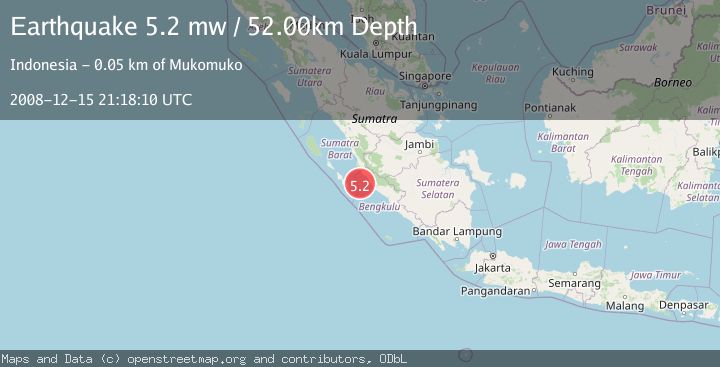
A 5.2 magnitude earthquake struck on SOUTHERN SUMATRA, INDONESIA, at Mon, 15 Dec 2008 21:18:10 GMT. Depth: 52km. Reviewed by EMSC seismologists, this moderate quake occurred at a magnitude type of mw.
Magnitude
5.2
mw
Source
EMSC
Intensity
-
Agency Reports
1 Sources| Source | Magnitude | Depth | Time |
|---|---|---|---|
| EMSCPrimary | 5.2 | 52 km | 17 years ago |
Earthquake Details
AutomaticEvent IDemsc_EMSC_20081215_0000086
Tsunami PotentialNo
Magnitude Typemw
Nearest Places
- Air Hitam45.1 km
- Desa Sinar Laut45.6 km
- Pondoklintang45.6 km
- Air Jubakpanang46.2 km
- Desa Teluk Bakung46.3 km
Comments
Join the discussion about this event.
Latest Earthquakes
3.1Mag
Timor Sea
Time3 minutes ago
Depth92.16 km
SourceVYT (Automatic)
2.5Mag
Timor Region
Time11 minutes ago
Depth11.14 km
SourceBMKG
1.2Mag
2 km N of Loma Linda, CA
Time12 minutes ago
Depth11.22 km
SourceUSGS (Automatic)
3.2Mag
Alaska Peninsula
Time12 minutes ago
Depth10.00 km
SourceVYT (Automatic)
4.3Mag
Southwest of Sumatra, Indonesia
Time16 minutes ago
Depth11.58 km
SourceBMKG
Nearby Earthquakes
5.0Mag
SOUTHERN SUMATRA, INDONESIA
Time16 years ago
Depth47.00 km
SourceNEIC (Automatic)
5.2Mag
SOUTHERN SUMATRA, INDONESIA
Time18 years ago
Depth30.00 km
SourceEMSC (Automatic)
5.0Mag
KEP. MENTAWAI REGION, INDONESIA
Time18 years ago
Depth48.00 km
SourceEMSC (Automatic)
5.0Mag
KEP. MENTAWAI REGION, INDONESIA
Time14 years ago
Depth60.00 km
SourceEMSC (Automatic)
3.0Mag
SOUTHERN SUMATRA, INDONESIA
Time1 month ago
Depth22.00 km
SourceBMKG (Automatic)