Earthquake KEPULAUAN BARAT DAYA, INDONESIA
Mon, 03 Feb 2014 22:36:40 GMT
Time12 years ago
Location
-7.1700, 128.2700
Depth
10.0 KM
Event Summary
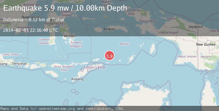
A 5.9 magnitude earthquake struck on KEPULAUAN BARAT DAYA, INDONESIA, at Mon, 03 Feb 2014 22:36:40 GMT. Depth: 10km. Reviewed by EMSC seismologists, this moderate quake occurred at a magnitude type of mw.
Magnitude
5.9
mw
Source
EMSC
Intensity
-
Agency Reports
1 Sources| Source | Magnitude | Depth | Time |
|---|---|---|---|
| EMSCPrimary | 5.9 | 10 km | 12 years ago |
Earthquake Details
AutomaticEvent IDemsc_EMSC_20140203_0000137
Tsunami PotentialNo
Magnitude Typemw
Nearest Places
- Pulau Musleur15.3 km
- Tanjung Tutitlakani28.8 km
- Desa Batu Merah31.3 km
- Desa Kumur34.6 km
- Pulau Terbang Utara35.2 km
Comments
Join the discussion about this event.
Latest Earthquakes
2.5Mag
Java, Indonesia
Time4 hours ago
Depth76.49 km
SourceBMKG
1.9Mag
Tarapaca, Chile
Time4 hours ago
Depth7.93 km
SourceVYT (Automatic)
2.4Mag
West Papua Region, Indonesia
Time4 hours ago
Depth10.00 km
SourceBMKG
2.7Mag
Antofagasta, Chile
Time4 hours ago
Depth0.00 km
SourceVYT (Automatic)
2.7Mag
Tarapaca, Chile
Time4 hours ago
Depth10.50 km
SourceVYT (Automatic)
Nearby Earthquakes
5.2Mag
KEPULAUAN BARAT DAYA, INDONESIA
Time12 years ago
Depth10.00 km
SourceEMSC (Automatic)
3.0Mag
Banda Sea
Time6 days ago
Depth211.06 km
SourceVYT (Automatic)
4.0Mag
Banda Sea
Time3 weeks ago
Depth185.83 km
SourceBMKG (Automatic)
5.1Mag
KEPULAUAN BARAT DAYA, INDONESIA
Time12 years ago
Depth4.00 km
SourceEMSC (Automatic)
5.0Mag
KEPULAUAN BARAT DAYA, INDONESIA
Time21 years ago
Depth10.00 km
SourceNEIC (Automatic)