Earthquake NEAR N COAST OF PAPUA, INDONESIA
Tue, 20 Sep 2016 13:10:47 GMT
Time9 years ago
Location
-1.9400, 138.8300
Depth
10.0 KM
Event Summary
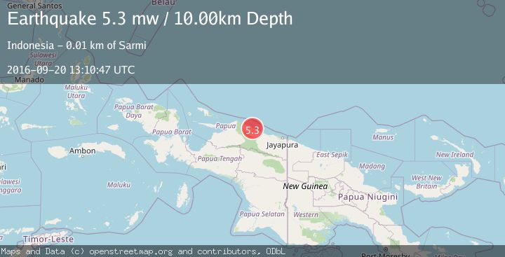
A 5.3 magnitude earthquake struck on NEAR N COAST OF PAPUA, INDONESIA, at Tue, 20 Sep 2016 13:10:47 GMT. Depth: 10km. Reviewed by EMSC seismologists, this moderate quake occurred at a magnitude type of mw.
Magnitude
5.3
mw
Source
EMSC
Intensity
-
Agency Reports
1 Sources| Source | Magnitude | Depth | Time |
|---|---|---|---|
| EMSCPrimary | 5.3 | 10 km | 9 years ago |
Earthquake Details
AutomaticEvent IDemsc_EMSC_20160920_0000068
Tsunami PotentialNo
Magnitude Typemw
Nearest Places
- Air Woske1.2 km
- Domosirawar1.7 km
- Teluk Maffin2.5 km
- Kampung Waskey3.0 km
- Air Sawrar3.4 km
Comments
Join the discussion about this event.
Latest Earthquakes
1.6Mag
Alaska Peninsula
Time3 minutes ago
Depth15.63 km
SourceVYT (Automatic)
2.2Mag
FRANCE
Time13 minutes ago
Depth5.00 km
SourceReNaSS (Automatic)
3.5Mag
Fox Islands, Aleutian Islands, Alaska
Time13 minutes ago
Depth72.63 km
SourceVYT (Automatic)
2.9Mag
STRAIT OF GIBRALTAR
Time13 minutes ago
Depth58.80 km
SourceIGN (Automatic)
1.8Mag
Kodiak Island region, Alaska
Time16 minutes ago
Depth208.13 km
SourceVYT (Automatic)
Nearby Earthquakes
5.6Mag
NEAR N COAST OF PAPUA, INDONESIA
Time7 years ago
Depth10.00 km
SourceEMSC (Automatic)
2.9Mag
Near North Coast of West Papua
Time2 weeks ago
Depth14.41 km
SourceBMKG (Automatic)
5.0Mag
NEAR N COAST OF PAPUA, INDONESIA
Time1 year ago
Depth12.40 km
SourceEMSC (Automatic)
2.9Mag
NEAR N COAST OF PAPUA, INDONESIA
Time1 week ago
Depth79.00 km
SourceBMKG (Automatic)
3.2Mag
NEAR N COAST OF PAPUA, INDONESIA
Time1 month ago
Depth10.00 km
SourceBMKG (Automatic)