Earthquake MAKASSAR STRAIT, INDONESIA
Fri, 18 May 2018 20:26:00 GMT
Time7 years ago
Location
1.0800, 119.9800
Depth
30.0 KM
Event Summary
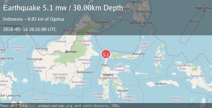
A 5.1 magnitude earthquake struck on MAKASSAR STRAIT, INDONESIA, at Fri, 18 May 2018 20:26:00 GMT. Depth: 30km. Reviewed by EMSC seismologists, this moderate quake occurred at a magnitude type of mw.
Magnitude
5.1
mw
Source
EMSC
Intensity
-
Agency Reports
1 Sources| Source | Magnitude | Depth | Time |
|---|---|---|---|
| EMSCPrimary | 5.1 | 30 km | 7 years ago |
Earthquake Details
AutomaticEvent IDemsc_EMSC_20180518_0000134
Tsunami PotentialNo
Magnitude Typemw
Nearest Places
- Pulau Lingayan31.0 km
- Lingayan31.2 km
- Pasie Stokan31.6 km
- Pasie Seranga31.9 km
- Pulau Koko31.9 km
Comments
Join the discussion about this event.
Latest Earthquakes
1.7Mag
Southern Alaska
Time13 hours ago
Depth16.24 km
SourceVYT (Automatic)
3.0Mag
Southern Alaska
Time14 hours ago
Depth53.34 km
SourceVYT (Automatic)
1.9Mag
Tarapaca, Chile
Time14 hours ago
Depth0.00 km
SourceVYT (Automatic)
2.4Mag
Sulawesi, Indonesia
Time14 hours ago
Depth4.26 km
SourceBMKG
2.2Mag
Northern Sumatra, Indonesia
Time14 hours ago
Depth8.25 km
SourceBMKG
Nearby Earthquakes
5.2Mag
MINAHASA, SULAWESI, INDONESIA
Time5 years ago
Depth10.00 km
SourceEMSC (Automatic)
5.1Mag
MINAHASA, SULAWESI, INDONESIA
Time7 years ago
Depth30.00 km
SourceEMSC (Automatic)
3.0Mag
MAKASSAR STRAIT, INDONESIA
Time2 years ago
Depth10.00 km
SourceBMKG (Automatic)
3.6Mag
Minahassa Peninsula, Sulawesi
Time2 weeks ago
Depth3.49 km
SourceBMKG (Automatic)
5.0Mag
MINAHASA, SULAWESI, INDONESIA
Time15 years ago
Depth40.00 km
SourceEMSC (Automatic)