Earthquake MOLUCCA SEA
Sun, 10 Feb 2019 01:08:47 GMT
Time7 years ago
Location
2.5900, 127.1700
Depth
46.0 KM
Event Summary
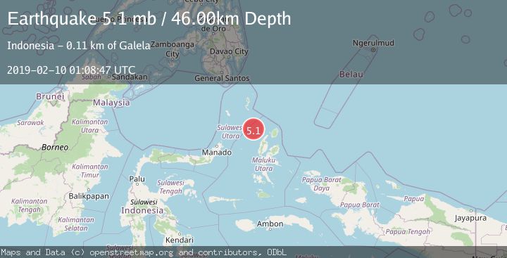
A 5.1 magnitude earthquake struck on MOLUCCA SEA, at Sun, 10 Feb 2019 01:08:47 GMT. Depth: 46km. Reviewed by EMSC seismologists, this moderate quake occurred at a magnitude type of mb.
Magnitude
5.1
mb
Source
EMSC
Intensity
-
Agency Reports
1 Sources| Source | Magnitude | Depth | Time |
|---|---|---|---|
| EMSCPrimary | 5.1 | 46 km | 7 years ago |
Earthquake Details
AutomaticEvent IDemsc_EMSC_20190210_0000006
Tsunami PotentialNo
Magnitude Typemb
Nearest Places
- Pulau Deherete72.6 km
- Pulau Laba74.0 km
- Pulau Sedeng74.9 km
- Tanjung Gurama75.4 km
- Desa Cera75.6 km
Comments
Join the discussion about this event.
Latest Earthquakes
2.8Mag
Sunda Strait, Indonesia
Time10 minutes ago
Depth3.61 km
SourceBMKG
3.6Mag
south of Alaska
Time11 minutes ago
Depth10.00 km
SourceVYT (Automatic)
1.2Mag
Central Alaska
Time13 minutes ago
Depth68.97 km
SourceVYT (Automatic)
1.2Mag
Washington
Time15 minutes ago
Depth0.00 km
SourceVYT (Automatic)
0.8Mag
10 km WNW of The Geysers, CA
Time21 minutes ago
Depth1.96 km
SourceUSGS (Automatic)
Nearby Earthquakes
3.2Mag
Northern Molucca Sea
Time3 weeks ago
Depth10.37 km
SourceBMKG (Automatic)
5.3Mag
MOLUCCA SEA
Time18 years ago
Depth35.00 km
SourceEMSC (Automatic)
5.5Mag
MOLUCCA SEA
Time18 years ago
Depth80.00 km
SourceEMSC (Automatic)
3.0Mag
MOLUCCA SEA
Time3 years ago
Depth10.00 km
SourceDJA (Automatic)
4.0Mag
MOLUCCA SEA
Time7 years ago
Depth117.00 km
SourceDJA (Automatic)