Earthquake MINDANAO, PHILIPPINES
Sun, 07 Feb 2021 04:22:56 GMT
Time5 years ago
Location
6.7800, 125.1700
Depth
22.0 KM
Event Summary
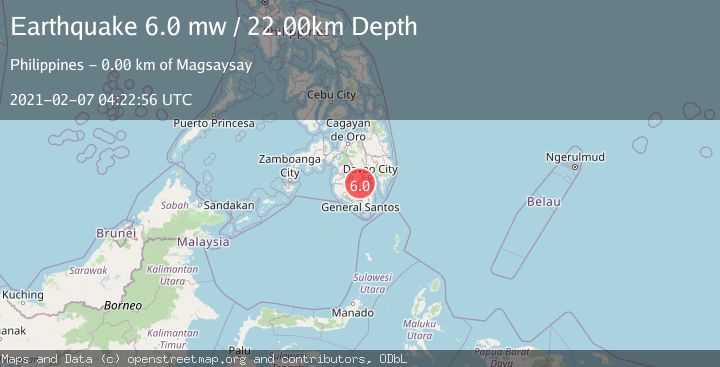
A 6.0 magnitude earthquake struck on MINDANAO, PHILIPPINES, at Sun, 07 Feb 2021 04:22:56 GMT. Depth: 22km. Reviewed by EMSC seismologists, this strong quake occurred at a magnitude type of mw.
Magnitude
6.0
mw
Source
EMSC
Intensity
-
Agency Reports
1 Sources| Source | Magnitude | Depth | Time |
|---|---|---|---|
| EMSCPrimary | 6.0 | 22 km | 5 years ago |
Earthquake Details
AutomaticEvent IDemsc_EMSC_20210207_0000028
Tsunami PotentialNo
Magnitude Typemw
Nearest Places
- Marber Stream0.9 km
- Carmen Creek1.0 km
- Magsaysay2.1 km
- Marber3.0 km
- Marber-Interior3.1 km
Comments
Join the discussion about this event.
Latest Earthquakes
3.1Mag
Timor region, Indonesia
Time2 minutes ago
Depth135.01 km
SourceVYT (Automatic)
2.5Mag
Timor Region
Time9 minutes ago
Depth11.14 km
SourceBMKG
1.2Mag
2 km N of Loma Linda, CA
Time10 minutes ago
Depth11.22 km
SourceUSGS (Automatic)
3.2Mag
Alaska Peninsula
Time11 minutes ago
Depth10.00 km
SourceVYT (Automatic)
4.3Mag
Southwest of Sumatra, Indonesia
Time15 minutes ago
Depth11.58 km
SourceBMKG
Nearby Earthquakes
5.3Mag
MINDANAO, PHILIPPINES
Time6 years ago
Depth10.00 km
SourceEMSC (Automatic)
3.0Mag
MINDANAO, PHILIPPINES
Time5 months ago
Depth13.00 km
SourcePIVS (Automatic)
3.0Mag
MINDANAO, PHILIPPINES
Time3 years ago
Depth1.00 km
SourcePIVS (Automatic)
3.0Mag
MINDANAO, PHILIPPINES
Time3 years ago
Depth22.00 km
SourcePIVS (Automatic)
5.0Mag
MINDANAO, PHILIPPINES
Time6 years ago
Depth30.00 km
SourceEMSC (Automatic)