Earthquake CENTRAL CALIFORNIA
Sat, 17 Jan 2026 14:12:00 GMT
Time1 month ago
Location
36.6578, -121.3127
Depth
5.4 KM
Event Summary
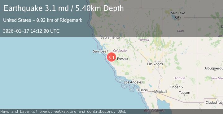
A 3.1 magnitude earthquake struck on CENTRAL CALIFORNIA, at Sat, 17 Jan 2026 14:12:00 GMT. Depth: 5.4km. Reviewed by NC seismologists, this minor quake occurred at a magnitude type of md.
Magnitude
3.1
md
Source
NC
Intensity
-
Agency Reports
1 Sources| Source | Magnitude | Depth | Time |
|---|---|---|---|
| NCPrimary | 3.1 | 6 km | 1 month ago |
Earthquake Details
AutomaticEvent IDemsc_NC_20260117_0000156
Tsunami PotentialNo
Magnitude Typemd
Nearest Places
- Three Troughs Canyon2.8 km
- Alvisa Canyon2.9 km
- Thousand Trail Resort4.2 km
- Matarana Gulch4.4 km
- Enz Vineyards4.5 km
Comments
Join the discussion about this event.
Latest Earthquakes
2.6Mag
Minahasa, Sulawesi, Indonesia
Time2 minutes ago
Depth3.17 km
SourceVYT (Automatic)
2.6Mag
Antofagasta, Chile
Time2 minutes ago
Depth125.12 km
SourceVYT (Automatic)
0.8Mag
7 km NW of The Geysers, CA
Time6 minutes ago
Depth1.32 km
SourceUSGS (Automatic)
2.7Mag
San Juan, Argentina
Time11 minutes ago
Depth363.53 km
SourceVYT (Automatic)
2.5Mag
Java, Indonesia
Time11 minutes ago
Depth115.43 km
SourceBMKG
Nearby Earthquakes
2.0Mag
14 km S of Tres Pinos, CA
Time2 weeks ago
Depth4.33 km
SourceUSGS (Automatic)
2.4Mag
CENTRAL CALIFORNIA
Time3 weeks ago
Depth3.10 km
SourceNC (Automatic)
1.7Mag
15 km S of Tres Pinos, CA
Time2 weeks ago
Depth2.12 km
SourceUSGS (Automatic)
2.6Mag
14 km S of Tres Pinos, CA
Time0 months ago
Depth6.66 km
SourceUSGS (Automatic)
2.2Mag
CENTRAL CALIFORNIA
Time1 month ago
Depth5.10 km
SourceNC (Automatic)