Earthquake SOUTHERN YUKON TERRITORY, CANADA
Fri, 09 Jan 2026 01:32:44 GMT
Time1 month ago
Location
60.5774, -140.0268
Depth
5.0 KM
Event Summary
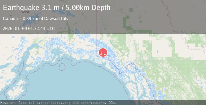
A 3.1 magnitude earthquake struck on SOUTHERN YUKON TERRITORY, CANADA, at Fri, 09 Jan 2026 01:32:44 GMT. Depth: 5km. Reviewed by NEIC seismologists, this minor quake occurred at a magnitude type of m.
Magnitude
3.1
m
Source
NEIC
Intensity
-
Agency Reports
1 Sources| Source | Magnitude | Depth | Time |
|---|---|---|---|
| NEICPrimary | 3.1 | 5 km | 1 month ago |
Earthquake Details
AutomaticEvent IDemsc_NEIC_20260109_0000023
Tsunami PotentialNo
Magnitude Typem
Nearest Places
- Marker Lake7.6 km
- McArthur Peak10.7 km
- Mount King George14.1 km
- Mount Queen Mary17.4 km
- Mount Logan20.7 km
Comments
Join the discussion about this event.
Latest Earthquakes
2.1Mag
Tarapaca, Chile
Time5 minutes ago
Depth8.18 km
SourceVYT (Automatic)
1.4Mag
12 km ESE of Olancha, CA
Time6 minutes ago
Depth7.15 km
SourceUSGS (Automatic)
2.8Mag
northwestern Russia
Time7 minutes ago
Depth10.00 km
SourceVYT (Automatic)
3.3Mag
Near North Coast of West Papua
Time7 minutes ago
Depth10.00 km
SourceBMKG
1.2Mag
5 km NNE of Fishhook, Alaska
Time8 minutes ago
Depth0.80 km
SourceUSGS (Automatic)
Nearby Earthquakes
2.2Mag
Southeastern Alaska
Time10 hours ago
Depth0.00 km
SourceVYT (Automatic)
2.8Mag
SOUTHERN YUKON TERRITORY, CANADA
Time2 weeks ago
Depth5.00 km
SourceCN (Automatic)
3.4Mag
SOUTHERN YUKON TERRITORY, CANADA
Time1 month ago
Depth5.00 km
SourceAK (Automatic)
3.0Mag
Southeastern Alaska
Time2 days ago
Depth0.00 km
SourceVYT (Automatic)
5.0Mag
SOUTHERN YUKON TERRITORY, CANADA
Time2 months ago
Depth10.00 km
SourceEMSC (Automatic)