Earthquake SOUTHERN ALASKA
Sat, 17 Jan 2026 05:47:20 GMT
Time1 month ago
Location
61.3384, -149.9367
Depth
35.0 KM
Event Summary
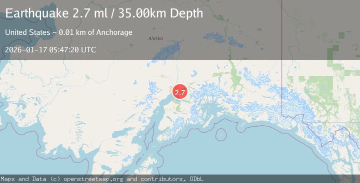
A 2.7 magnitude earthquake struck on SOUTHERN ALASKA, at Sat, 17 Jan 2026 05:47:20 GMT. Depth: 35km. Reviewed by NEIC seismologists, this minor quake occurred at a magnitude type of ml.
Magnitude
2.7
ml
Source
NEIC
Intensity
-
Agency Reports
1 Sources| Source | Magnitude | Depth | Time |
|---|---|---|---|
| NEICPrimary | 2.7 | 35 km | 1 month ago |
Earthquake Details
AutomaticEvent IDemsc_NEIC_20260117_0000333
Tsunami PotentialNo
Magnitude Typeml
Nearest Places
- Mule Creek1.8 km
- Lost Lake3.2 km
- Point MacKenzie3.3 km
- Lost Lake Seaplane Base3.6 km
- Elmendorf Moraine4.4 km
Comments
Join the discussion about this event.
Latest Earthquakes
1.4Mag
Southern Alaska
Time2 minutes ago
Depth44.07 km
SourceVYT (Automatic)
0.7Mag
8 km NW of The Geysers, CA
Time8 minutes ago
Depth1.59 km
SourceUSGS (Automatic)
1.2Mag
Southern Alaska
Time10 minutes ago
Depth16.72 km
SourceVYT (Automatic)
1.6Mag
49 km W of Mentone, Texas
Time10 minutes ago
Depth4.59 km
SourceUSGS (Automatic)
3.1Mag
northern Colombia
Time12 minutes ago
Depth219.97 km
SourceVYT (Automatic)
Nearby Earthquakes
3.0Mag
SOUTHERN ALASKA
Time7 years ago
Depth38.00 km
SourceNEIC (Automatic)
2.6Mag
SOUTHERN ALASKA
Time1 month ago
Depth38.20 km
SourceNEIC (Automatic)
3.0Mag
SOUTHERN ALASKA
Time7 years ago
Depth32.00 km
SourceNEIC (Automatic)
4.0Mag
SOUTHERN ALASKA
Time6 years ago
Depth46.00 km
SourceNEIC (Automatic)
3.0Mag
SOUTHERN ALASKA
Time7 years ago
Depth42.00 km
SourceNEIR (Automatic)