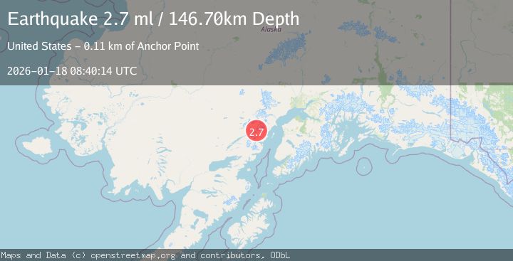
Earthquake SOUTHERN ALASKA
Sun, 18 Jan 2026 08:40:14 GMT
Time1 month ago
Location
60.5813, -152.9303
Depth
146.7 KM
Event Summary
A 2.7 magnitude earthquake struck on SOUTHERN ALASKA, at Sun, 18 Jan 2026 08:40:14 GMT. Depth: 146.7km. Reviewed by NEIC seismologists, this minor quake occurred at a magnitude type of ml.
Magnitude
2.7
ml
Source
NEIC
Intensity
-
Agency Reports
1 Sources| Source | Magnitude | Depth | Time |
|---|---|---|---|
| NEICPrimary | 2.7 | 138 km | 1 month ago |
Earthquake Details
AutomaticEvent IDemsc_NEIC_20260118_0000112
Tsunami PotentialNo
Magnitude Typeml
Nearest Places
- Redoubt Volcano14.8 km
- North Fork Tlikakila River15.3 km
- Double Glacier17.1 km
- Lake Clark National Park17.8 km
- Double Glacier17.9 km
Comments
Join the discussion about this event.
Latest Earthquakes
1.9Mag
Kenai Peninsula, Alaska
Time2 minutes ago
Depth67.87 km
SourceVYT (Automatic)
1.2Mag
Southeastern Alaska
Time7 minutes ago
Depth35.28 km
SourceVYT (Automatic)
3.3Mag
off the coast of Libertador O'Higgins, Chile
Time11 minutes ago
Depth10.00 km
SourceVYT (Automatic)
1.0Mag
6 km SSW of Redlands, CA
Time12 minutes ago
Depth10.39 km
SourceUSGS (Automatic)
1.9Mag
Central Alaska
Time16 minutes ago
Depth7.57 km
SourceVYT (Automatic)
Nearby Earthquakes
0.8Mag
Southern Alaska
Time3 days ago
Depth0.00 km
SourceVYT (Automatic)
1.2Mag
Southern Alaska
Time5 days ago
Depth7.81 km
SourceVYT (Automatic)
3.0Mag
SOUTHERN ALASKA
Time9 years ago
Depth135.00 km
SourceNEIC (Automatic)
1.1Mag
Southern Alaska
Time3 days ago
Depth7.81 km
SourceVYT (Automatic)
2.7Mag
Southern Alaska
Time3 days ago
Depth169.43 km
SourceVYT (Automatic)