Earthquake MORO GULF, MINDANAO, PHILIPPINES
Wed, 28 Jan 2026 07:11:15 GMT
Time3 weeks ago
Location
6.3413, 123.6363
Depth
10.0 KM
Event Summary
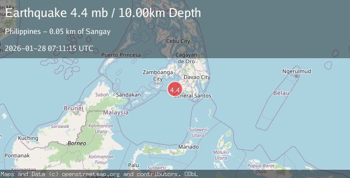
A 4.4 magnitude earthquake struck on MORO GULF, MINDANAO, PHILIPPINES, at Wed, 28 Jan 2026 07:11:15 GMT. Depth: 10km. Reviewed by NEIC seismologists, this light quake occurred at a magnitude type of mb.
Magnitude
4.4
mb
Source
NEIC
Intensity
-
Agency Reports
1 Sources| Source | Magnitude | Depth | Time |
|---|---|---|---|
| NEICPrimary | 4.4 | 10 km | 3 weeks ago |
Earthquake Details
AutomaticEvent IDemsc_NEIC_20260128_0000473
Tsunami PotentialNo
Magnitude Typemb
Nearest Places
- 43.7 km
- 44.6 km
- 45.2 km
- 45.5 km
- 45.6 km
Comments
Join the discussion about this event.
Latest Earthquakes
1.6Mag
Tarapaca, Chile
Time2 minutes ago
Depth0.00 km
SourceVYT (Automatic)
2.7Mag
Fox Islands, Aleutian Islands, Alaska
Time5 minutes ago
Depth17.09 km
SourceVYT (Automatic)
2.0Mag
Tarapaca, Chile
Time5 minutes ago
Depth117.07 km
SourceVYT (Automatic)
2.8Mag
Fox Islands, Aleutian Islands, Alaska
Time10 minutes ago
Depth8.54 km
SourceVYT (Automatic)
1.1Mag
2 km NW of The Geysers, CA
Time10 minutes ago
Depth1.50 km
SourceUSGS (Automatic)
Nearby Earthquakes
4.4Mag
MORO GULF, MINDANAO, PHILIPPINES
Time3 weeks ago
Depth10.00 km
SourceNEIC (Automatic)
5.3Mag
MORO GULF, MINDANAO, PHILIPPINES
Time3 weeks ago
Depth25.00 km
SourcePIVS (Automatic)
3.0Mag
MORO GULF, MINDANAO, PHILIPPINES
Time1 week ago
Depth23.00 km
SourcePIVS (Automatic)
3.3Mag
MORO GULF, MINDANAO, PHILIPPINES
Time1 month ago
Depth4.00 km
SourcePIVS (Automatic)
3.4Mag
MORO GULF, MINDANAO, PHILIPPINES
Time4 days ago
Depth17.00 km
SourcePIVS (Automatic)