Earthquake WESTERN TEXAS
Sat, 07 Feb 2026 04:03:30 GMT
Time1 hour ago
Location
31.6491, -104.2062
Depth
10.0 KM
Event Summary
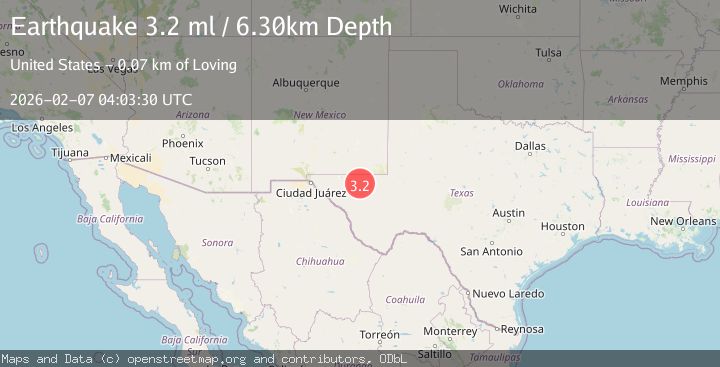
A 3.2 magnitude earthquake struck on WESTERN TEXAS, at Sat, 07 Feb 2026 04:03:30 GMT. Depth: 10km. Reviewed by NEIC seismologists, this minor quake occurred at a magnitude type of ml.
Magnitude
3.2
ml
Source
NEIC
Intensity
-
Agency Reports
3 Sources| Source | Magnitude | Depth | Time |
|---|---|---|---|
| NEICPrimary | 3.2 | 10 km | 1 hour ago |
| USGS | 3.2 | 10 km | 1 hour ago |
| TX | 3.2 | 6 km | 1 hour ago |
Earthquake Details
AutomaticEvent IDemsc_NEIC_20260207_0000059
Tsunami PotentialNo
Magnitude Typeml
Nearest Places
- Cedar Pasture Draw1.9 km
- Rustler Spring2.0 km
- Monument Windmill2.7 km
- Kohen Windmill3.4 km
- Rustler Hills3.9 km
Comments
Join the discussion about this event.
Latest Earthquakes
0.8Mag
5 km E of Badger, Alaska
Time2 minutes ago
Depth18.30 km
SourceUSGS (Automatic)
2.4Mag
Timor Region
Time2 minutes ago
Depth47.37 km
SourceBMKG (Automatic)
2.6Mag
PUERTO RICO REGION
Time15 minutes ago
Depth9.50 km
SourcePR (Automatic)
2.4Mag
Sumba Region, Indonesia
Time17 minutes ago
Depth57.80 km
SourceBMKG (Automatic)
2.6Mag
ANTOFAGASTA, CHILE
Time18 minutes ago
Depth130.80 km
SourceCSN (Automatic)
Nearby Earthquakes
1.9Mag
54 km NW of Toyah, Texas
Time1 week ago
Depth4.50 km
SourceUSGS (Automatic)
1.7Mag
55 km NW of Toyah, Texas
Time1 week ago
Depth7.18 km
SourceUSGS
1.8Mag
55 km NW of Toyah, Texas
Time2 weeks ago
Depth4.58 km
SourceUSGS (Automatic)
1.7Mag
55 km NW of Toyah, Texas
Time4 days ago
Depth4.04 km
SourceUSGS (Automatic)
1.6Mag
57 km NW of Toyah, Texas
Time6 hours ago
Depth4.34 km
SourceUSGS (Automatic)