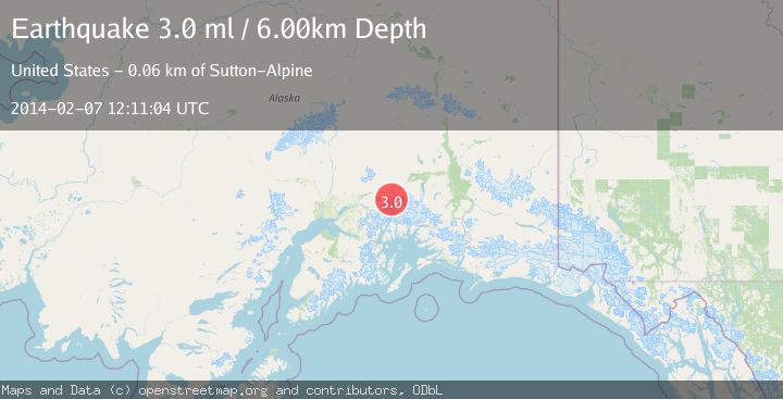
Earthquake SOUTHERN ALASKA
Fri, 07 Feb 2014 12:11:04 GMT
Time12 years ago
Location
61.6200, -147.7400
Depth
6.0 KM
Event Summary
A 3.0 magnitude earthquake struck on SOUTHERN ALASKA, at Fri, 07 Feb 2014 12:11:04 GMT. Depth: 6km. Reviewed by NEIR seismologists, this minor quake occurred at a magnitude type of ml.
Magnitude
3.0
ml
Source
NEIR
Intensity
-
Agency Reports
1 Sources| Source | Magnitude | Depth | Time |
|---|---|---|---|
| NEIRPrimary | 3.0 | 6 km | 12 years ago |
Earthquake Details
AutomaticEvent IDemsc_NEIR_20140207_0000047
Tsunami PotentialNo
Magnitude Typeml
Nearest Places
- Mount Sergeant Robinson7.5 km
- Harvard Glacier8.5 km
- Matanuska Glacier9.3 km
- Glacier Point10.0 km
- Mount Wickersham10.1 km
Comments
Join the discussion about this event.
Latest Earthquakes
3.4Mag
San Juan, Argentina
Time7 minutes ago
Depth10.00 km
SourceVYT (Automatic)
3.0Mag
Potosi, Bolivia
Time10 minutes ago
Depth269.04 km
SourceVYT (Automatic)
2.4Mag
Central Alaska
Time12 minutes ago
Depth0.24 km
SourceVYT (Automatic)
3.7Mag
Seram, Indonesia
Time12 minutes ago
Depth0.00 km
SourceVYT (Automatic)
3.9Mag
North of Halmahera, Indonesia
Time13 minutes ago
Depth14.71 km
SourceBMKG
Nearby Earthquakes
1.4Mag
13 km SSW of Glacier View, Alaska
Time5 days ago
Depth37.80 km
SourceUSGS (Automatic)
3.0Mag
SOUTHERN ALASKA
Time6 years ago
Depth22.00 km
SourceNEIC (Automatic)
1.4Mag
8 km S of Glacier View, Alaska
Time1 week ago
Depth29.40 km
SourceUSGS (Automatic)
1.6Mag
17 km SSE of Glacier View, Alaska
Time2 weeks ago
Depth28.40 km
SourceUSGS (Automatic)
1.7Mag
Southern Alaska
Time2 days ago
Depth0.00 km
SourceVYT (Automatic)