Earthquake SOUTHERN CALIFORNIA
Sat, 10 Jan 2015 23:29:02 GMT
Time11 years ago
Location
33.4800, -116.4400
Depth
14.0 KM
Event Summary
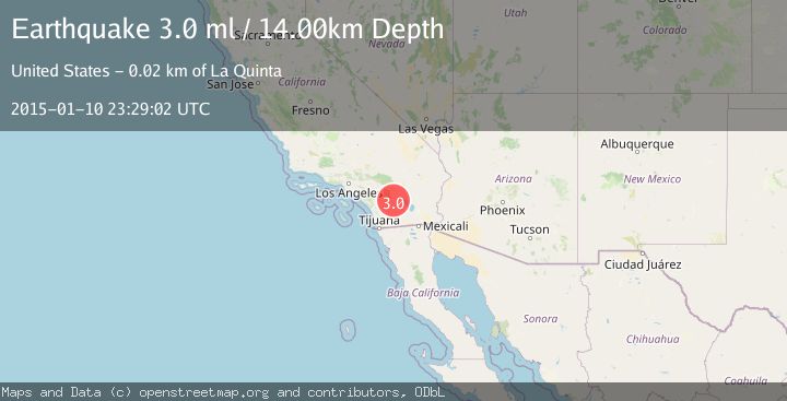
A 3.0 magnitude earthquake struck on SOUTHERN CALIFORNIA, at Sat, 10 Jan 2015 23:29:02 GMT. Depth: 14km. Reviewed by NEIR seismologists, this minor quake occurred at a magnitude type of ml.
Magnitude
3.0
ml
Source
NEIR
Intensity
-
Agency Reports
1 Sources| Source | Magnitude | Depth | Time |
|---|---|---|---|
| NEIRPrimary | 3.0 | 14 km | 11 years ago |
Earthquake Details
AutomaticEvent IDemsc_NEIR_20150110_0000116
Tsunami PotentialNo
Magnitude Typeml
Nearest Places
- Toro Spring2.4 km
- Nicholias Canyon3.1 km
- Buck Ridge3.8 km
- Alder Canyon5.0 km
- Toro Peak5.0 km
Comments
Join the discussion about this event.
Latest Earthquakes
2.3Mag
Tarapaca, Chile
Time1 minute ago
Depth114.14 km
SourceVYT (Automatic)
2.1Mag
Southern Alaska
Time5 minutes ago
Depth67.26 km
SourceVYT (Automatic)
2.2Mag
western Russia
Time8 minutes ago
Depth0.00 km
SourceVYT (Automatic)
1.5Mag
4 km NNW of The Geysers, CA
Time9 minutes ago
Depth-0.27 km
SourceUSGS (Automatic)
1.0Mag
9 km WNW of Two Rivers, Alaska
Time9 minutes ago
Depth5.70 km
SourceUSGS (Automatic)
Nearby Earthquakes
1.3Mag
22 km ESE of Anza, CA
Time2 hours ago
Depth13.66 km
SourceUSGS (Automatic)
1.4Mag
23 km SSW of La Quinta, CA
Time3 weeks ago
Depth14.11 km
SourceUSGS (Automatic)
1.0Mag
24 km ESE of Anza, CA
Time2 weeks ago
Depth3.61 km
SourceUSGS (Automatic)
1.0Mag
22 km SSW of La Quinta, CA
Time1 week ago
Depth6.34 km
SourceUSGS (Automatic)
1.3Mag
24 km N of Borrego Springs, CA
Time2 days ago
Depth3.27 km
SourceUSGS (Automatic)