Earthquake 22 km SSW of La Quinta, CA
Sun, 08 Feb 2026 19:47:59 GMT
Time6 hours ago
Location
33.4893, -116.4290
Depth
6.3 KM
Event Summary
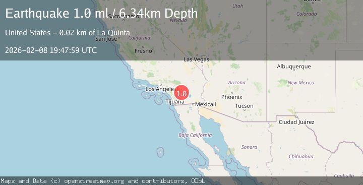
A 1.0 magnitude earthquake struck on 22 km SSW of La Quinta, CA, at Sun, 08 Feb 2026 19:47:59 GMT. Depth: 6.34000015258789km. Reviewed by USGS seismologists, this minor quake occurred at a magnitude type of ml.
Magnitude
1.0
ml
Source
USGS
Intensity
-
Agency Reports
1 Sources| Source | Magnitude | Depth | Time |
|---|---|---|---|
| USGSPrimary | 1.0 | 6 km | 6 hours ago |
Earthquake Details
AutomaticEvent IDusgs_ci41394080
Tsunami PotentialNo
Magnitude Typeml
Nearest Places
- Toro Spring1.9 km
- Nicholias Canyon2.9 km
- Toro Peak3.8 km
- Buck Ridge3.9 km
- Old Santa Rosa Indian Ruins4.4 km
Comments
Join the discussion about this event.
Latest Earthquakes
1.7Mag
EASTERN MEDITERRANEAN SEA
Time51 minutes ago
Depth7.10 km
SourceAFAD (Automatic)
1.1Mag
CENTRAL TURKEY
Time55 minutes ago
Depth7.00 km
SourceAFAD (Automatic)
1.1Mag
12 km SSE of Anza, CA
Time1 hour ago
Depth9.30 km
SourceUSGS (Automatic)
3.2Mag
Celebes Sea
Time1 hour ago
Depth7.00 km
SourceBMKG (Automatic)
1.3Mag
WESTERN TURKEY
Time1 hour ago
Depth7.00 km
SourceAFAD (Automatic)
Nearby Earthquakes
1.4Mag
23 km SSW of La Quinta, CA
Time1 week ago
Depth14.11 km
SourceUSGS (Automatic)
2.3Mag
21 km SSW of La Quinta, CA
Time2 weeks ago
Depth9.31 km
SourceUSGS (Automatic)
1.4Mag
21 km SW of La Quinta, CA
Time5 days ago
Depth7.54 km
SourceUSGS (Automatic)
1.0Mag
24 km ESE of Anza, CA
Time1 week ago
Depth3.61 km
SourceUSGS (Automatic)
1.4Mag
23 km SSW of La Quinta, CA
Time1 day ago
Depth12.80 km
SourceUSGS (Automatic)