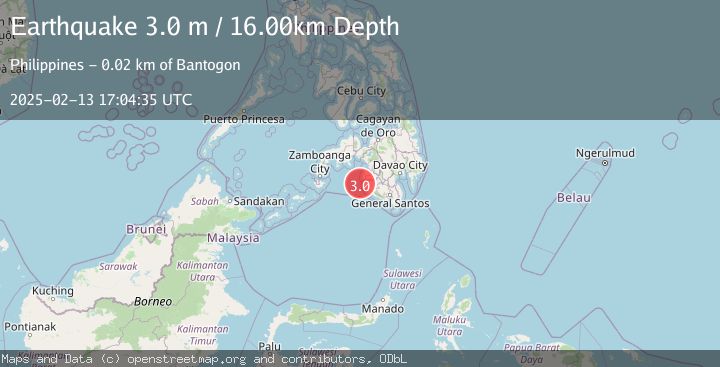
Earthquake MORO GULF, MINDANAO, PHILIPPINES
Thu, 13 Feb 2025 17:04:35 GMT
Time1 year ago
Location
6.5900, 123.8600
Depth
16.0 KM
Event Summary
A 3.0 magnitude earthquake struck on MORO GULF, MINDANAO, PHILIPPINES, at Thu, 13 Feb 2025 17:04:35 GMT. Depth: 16km. Reviewed by PIVS seismologists, this minor quake occurred at a magnitude type of m.
Magnitude
3.0
m
Source
PIVS
Intensity
-
Agency Reports
1 Sources| Source | Magnitude | Depth | Time |
|---|---|---|---|
| PIVSPrimary | 3.0 | 16 km | 1 year ago |
Earthquake Details
AutomaticEvent IDemsc_PIVS_20250213_0000228
Tsunami PotentialNo
Magnitude Typem
Nearest Places
- Donaung Shoals15.6 km
- Nara Point18.9 km
- Pidtaguinan Point19.1 km
- Poral Point19.3 km
- Lebak Island19.7 km
Comments
Join the discussion about this event.
Latest Earthquakes
1.9Mag
Kenai Peninsula, Alaska
Time15 hours ago
Depth67.87 km
SourceVYT (Automatic)
1.2Mag
Southeastern Alaska
Time15 hours ago
Depth35.28 km
SourceVYT (Automatic)
3.3Mag
off the coast of Libertador O'Higgins, Chile
Time15 hours ago
Depth10.00 km
SourceVYT (Automatic)
1.0Mag
6 km SSW of Redlands, CA
Time15 hours ago
Depth10.39 km
SourceUSGS (Automatic)
1.9Mag
Central Alaska
Time15 hours ago
Depth7.57 km
SourceVYT (Automatic)
Nearby Earthquakes
5.8Mag
MORO GULF, MINDANAO, PHILIPPINES
Time13 years ago
Depth40.00 km
SourceEMSC (Automatic)
5.0Mag
MORO GULF, MINDANAO, PHILIPPINES
Time13 years ago
Depth10.00 km
SourceEMSC (Automatic)
3.0Mag
MORO GULF, MINDANAO, PHILIPPINES
Time3 years ago
Depth28.00 km
SourcePIVS (Automatic)
2.0Mag
Mindanao, Philippines
Time3 weeks ago
Depth13.00 km
SourceMAN (Automatic)
4.9Mag
Mindanao, Philippines
Time3 weeks ago
Depth52.86 km
SourceBMKG (Automatic)