Earthquake MORO GULF, MINDANAO, PHILIPPINES
Sun, 01 Feb 2026 19:57:15 GMT
Time1 day ago
Location
6.4200, 123.7300
Depth
9.0 KM
Event Summary
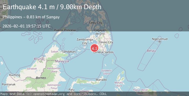
A 4.1 magnitude earthquake struck on MORO GULF, MINDANAO, PHILIPPINES, at Sun, 01 Feb 2026 19:57:15 GMT. Depth: 9km. Reviewed by PIVS seismologists, this light quake occurred at a magnitude type of m.
Magnitude
4.1
m
Source
PIVS
Intensity
-
Agency Reports
1 Sources| Source | Magnitude | Depth | Time |
|---|---|---|---|
| PIVSPrimary | 4.1 | 9 km | 1 day ago |
Earthquake Details
AutomaticEvent IDemsc_PIVS_20260201_0000272
Tsunami PotentialNo
Magnitude Typem
Nearest Places
- Donaung Shoals30.6 km
- Donauang Island32.6 km
- Basiauang Bay33.4 km
- Danawan Point33.5 km
- Basiauang Point33.8 km
Comments
Join the discussion about this event.
Latest Earthquakes
1.5Mag
13 km E of Pearsall, Texas
Time1 hour ago
Depth8.04 km
SourceUSGS (Automatic)
3.0Mag
Southern Sumatra, Indonesia
Time1 hour ago
Depth10.00 km
SourceBMKG (Automatic)
1.2Mag
24 km NE of Minto, Alaska
Time1 hour ago
Depth6.60 km
SourceUSGS (Automatic)
1.5Mag
18 km NNE of Indio, CA
Time1 hour ago
Depth3.26 km
SourceUSGS (Automatic)
1.2Mag
8 km SSW of Mojave, CA
Time1 hour ago
Depth1.66 km
SourceUSGS (Automatic)
Nearby Earthquakes
5.4Mag
Mindanao, Philippines
Time5 days ago
Depth16.72 km
SourceBMKG (Automatic)
3.4Mag
MORO GULF, MINDANAO, PHILIPPINES
Time1 week ago
Depth9.00 km
SourcePIVS (Automatic)
3.2Mag
MORO GULF, MINDANAO, PHILIPPINES
Time1 week ago
Depth1.00 km
SourcePIVS (Automatic)
4.2Mag
MORO GULF, MINDANAO, PHILIPPINES
Time1 week ago
Depth10.00 km
SourcePIVS (Automatic)
3.6Mag
MORO GULF, MINDANAO, PHILIPPINES
Time1 week ago
Depth6.00 km
SourcePIVS (Automatic)