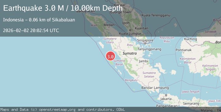
Earthquake Southern Sumatra, Indonesia
Mon, 02 Feb 2026 20:02:54 GMT
Time1 hour ago
Location
-0.5479, 98.8842
Depth
10.0 KM
Event Summary
A 3.0 magnitude earthquake struck on Southern Sumatra, Indonesia, at Mon, 02 Feb 2026 20:02:54 GMT. Depth: 10km. Reviewed by BMKG seismologists, this minor quake occurred at a magnitude type of M.
Magnitude
3.0
M
Source
BMKG
Intensity
-
Agency Reports
1 Sources| Source | Magnitude | Depth | Time |
|---|---|---|---|
| BMKGPrimary | 3.0 | 10 km | 1 hour ago |
Earthquake Details
AutomaticEvent IDbmg2026chzu
Tsunami PotentialNo
Magnitude TypeM
Nearest Places
- Selat Siberut37.9 km
- Tanjung Simabae40.4 km
- Makasser Reef40.9 km
- Desa Bawo Analita Saeru41.1 km
- Pulau Orasa41.8 km
Comments
Join the discussion about this event.
Latest Earthquakes
1.2Mag
24 km NE of Minto, Alaska
Time1 hour ago
Depth6.60 km
SourceUSGS (Automatic)
1.5Mag
18 km NNE of Indio, CA
Time1 hour ago
Depth3.26 km
SourceUSGS (Automatic)
1.2Mag
8 km SSW of Mojave, CA
Time1 hour ago
Depth1.66 km
SourceUSGS (Automatic)
3.3Mag
KODIAK ISLAND REGION, ALASKA
Time2 hours ago
Depth19.20 km
SourceAK (Automatic)
2.8Mag
76 km NNE of Aleneva, Alaska
Time2 hours ago
Depth26.90 km
SourceUSGS (Automatic)
Nearby Earthquakes
2.7Mag
Southern Sumatra, Indonesia
Time1 week ago
Depth22.17 km
SourceBMKG (Automatic)
3.6Mag
Southern Sumatra, Indonesia
Time2 days ago
Depth41.61 km
SourceBMKG (Automatic)
2.8Mag
Southern Sumatra, Indonesia
Time4 days ago
Depth38.19 km
SourceBMKG (Automatic)
4.1Mag
KEP. MENTAWAI REGION, INDONESIA
Time1 week ago
Depth48.00 km
SourceBMKG (Automatic)
4.5Mag
Southern Sumatra, Indonesia
Time23 hours ago
Depth23.34 km
SourceBMKG (Automatic)