Earthquake 18 km NNE of Indio, CA
Mon, 02 Feb 2026 19:59:16 GMT
Time1 hour ago
Location
33.8795, -116.1740
Depth
3.3 KM
Event Summary
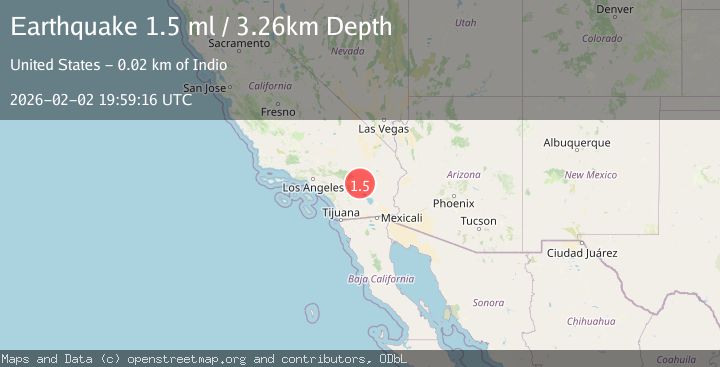
A 1.5 magnitude earthquake struck on 18 km NNE of Indio, CA, at Mon, 02 Feb 2026 19:59:16 GMT. Depth: 3.25999999046326km. Reviewed by USGS seismologists, this minor quake occurred at a magnitude type of ml.
Magnitude
1.5
ml
Source
USGS
Intensity
-
Agency Reports
1 Sources| Source | Magnitude | Depth | Time |
|---|---|---|---|
| USGSPrimary | 1.5 | 3 km | 1 hour ago |
Earthquake Details
AutomaticEvent IDusgs_ci41178407
Tsunami PotentialNo
Magnitude Typeml
Nearest Places
- Cabezon Indian Reservation2.1 km
- The Blue Cut4.4 km
- Pushawalla Canyon4.8 km
- Hidden Gold Mine4.9 km
- KPLM-FM (Palm Springs)5.1 km
Comments
Join the discussion about this event.
Latest Earthquakes
2.8Mag
Sulawesi, Indonesia
Time12 minutes ago
Depth10.00 km
SourceBMKG (Automatic)
1.5Mag
5 km SE of San Ramon, CA
Time12 minutes ago
Depth6.55 km
SourceUSGS (Automatic)
3.1Mag
NEAR S.E. COAST OF AUSTRALIA
Time13 minutes ago
Depth10.00 km
SourceAUST (Automatic)
3.8Mag
Southern Sumatra, Indonesia
Time14 minutes ago
Depth10.00 km
SourceBMKG (Automatic)
2.4Mag
West Papua Region, Indonesia
Time21 minutes ago
Depth9.36 km
SourceBMKG (Automatic)
Nearby Earthquakes
1.5Mag
18 km NNE of Indio, CA
Time1 week ago
Depth4.65 km
SourceUSGS (Automatic)
1.6Mag
18 km NNE of Indio, CA
Time2 days ago
Depth3.87 km
SourceUSGS (Automatic)
1.6Mag
18 km NNE of Indio, CA
Time2 days ago
Depth3.99 km
SourceUSGS (Automatic)
1.0Mag
18 km NNE of Indio, CA
Time2 days ago
Depth4.56 km
SourceUSGS (Automatic)
1.1Mag
18 km NNE of Indio, CA
Time1 day ago
Depth4.23 km
SourceUSGS (Automatic)