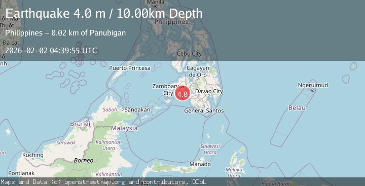
Earthquake MINDANAO, PHILIPPINES
Mon, 02 Feb 2026 04:39:55 GMT
Time20 hours ago
Location
7.2500, 123.3500
Depth
10.0 KM
Event Summary
A 4.0 magnitude earthquake struck on MINDANAO, PHILIPPINES, at Mon, 02 Feb 2026 04:39:55 GMT. Depth: 10km. Reviewed by PIVS seismologists, this light quake occurred at a magnitude type of m.
Magnitude
4.0
m
Source
PIVS
Intensity
-
Agency Reports
1 Sources| Source | Magnitude | Depth | Time |
|---|---|---|---|
| PIVSPrimary | 4.0 | 10 km | 20 hours ago |
Earthquake Details
AutomaticEvent IDemsc_PIVS_20260202_0000065
Tsunami PotentialNo
Magnitude Typem
Nearest Places
- Flecha Point13.5 km
- Minus13.7 km
- Paniguian Island14.0 km
- Gadugan14.2 km
- Baganian Mountain Range14.9 km
Comments
Join the discussion about this event.
Latest Earthquakes
0.7Mag
7 km NW of The Geysers, CA
Time20 hours ago
Depth2.56 km
SourceUSGS (Automatic)
3.2Mag
Halmahera, Indonesia
Time20 hours ago
Depth98.16 km
SourceBMKG (Automatic)
1.6Mag
48 km SSW of Cantwell, Alaska
Time20 hours ago
Depth68.10 km
SourceUSGS (Automatic)
2.8Mag
Southern Sumatra, Indonesia
Time20 hours ago
Depth73.10 km
SourceBMKG (Automatic)
1.1Mag
37 km NW of Stanton, Texas
Time20 hours ago
Depth4.03 km
SourceUSGS (Automatic)
Nearby Earthquakes
5.9Mag
Mindanao, Philippines
Time5 days ago
Depth197.88 km
SourceBMKG (Automatic)
4.8Mag
Mindanao, Philippines
Time2 days ago
Depth565.17 km
SourceBMKG (Automatic)
5.3Mag
Mindanao, Philippines
Time4 days ago
Depth16.19 km
SourceBMKG (Automatic)
3.1Mag
MORO GULF, MINDANAO, PHILIPPINES
Time1 week ago
Depth19.00 km
SourcePIVS (Automatic)
5.1Mag
MORO GULF, MINDANAO, PHILIPPINES
Time5 days ago
Depth7.00 km
SourcePIVS (Automatic)