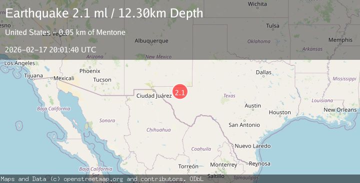
Earthquake WESTERN TEXAS
Tue, 17 Feb 2026 20:01:40 GMT
Time16 hours ago
Location
31.6330, -104.1340
Depth
12.3 KM
Event Summary
A 2.1 magnitude earthquake struck on WESTERN TEXAS, at Tue, 17 Feb 2026 20:01:40 GMT. Depth: 12.3km. Reviewed by TX seismologists, this minor quake occurred at a magnitude type of ml.
Magnitude
2.1
ml
Source
TX
Intensity
-
Agency Reports
1 Sources| Source | Magnitude | Depth | Time |
|---|---|---|---|
| TXPrimary | 2.1 | 12 km | 16 hours ago |
Earthquake Details
AutomaticEvent IDemsc_TX_20260217_0000318
Tsunami PotentialNo
Magnitude Typeml
Nearest Places
- Old Michigan Mine4.6 km
- Monument Windmill4.6 km
- Monument Draw4.7 km
- Kohen Windmill6.0 km
- Rustler Hills6.7 km
Comments
Join the discussion about this event.
Latest Earthquakes
2.0Mag
Southern California
Time15 hours ago
Depth0.00 km
SourceVYT (Automatic)
1.4Mag
Southern Alaska
Time15 hours ago
Depth11.84 km
SourceVYT (Automatic)
2.1Mag
Tarapaca, Chile
Time15 hours ago
Depth30.27 km
SourceVYT (Automatic)
2.6Mag
COQUIMBO, CHILE
Time15 hours ago
Depth31.30 km
SourceCSN (Automatic)
3.7Mag
Halmahera, Indonesia
Time15 hours ago
Depth287.72 km
SourceVYT (Automatic)
Nearby Earthquakes
1.4Mag
48 km NW of Toyah, Texas
Time1 week ago
Depth4.61 km
SourceUSGS (Automatic)
1.5Mag
47 km NW of Toyah, Texas
Time4 days ago
Depth4.80 km
SourceUSGS (Automatic)
2.2Mag
WESTERN TEXAS
Time1 month ago
Depth5.50 km
SourceTX (Automatic)
2.0Mag
western Texas
Time1 day ago
Depth0.12 km
SourceVYT (Automatic)
1.6Mag
44 km NW of Toyah, Texas
Time2 weeks ago
Depth4.20 km
SourceUSGS (Automatic)