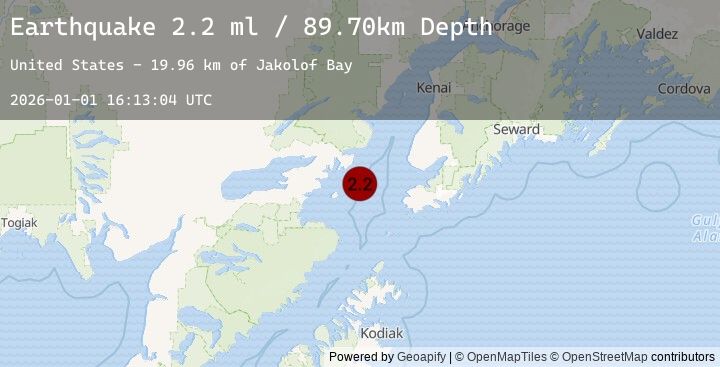
Earthquake 56 km WNW of Nanwalek, Alaska
Thu, 01 Jan 2026 16:13:04 GMT
Time1 hour ago
Location
59.4980, -152.8810
Depth
89.7 KM
Event Summary
A 2.2 magnitude earthquake struck on 56 km WNW of Nanwalek, Alaska, at Thu, 01 Jan 2026 16:13:04 GMT. Depth: 89.7km. Reviewed by USGS seismologists, this minor quake occurred at a magnitude type of ml.
Magnitude
2.2
ml
Source
USGS
Intensity
-
Earthquake Details
AutomaticEvent IDusgs_ak2026abggnt
Tsunami PotentialNo
Magnitude Typeml
Nearest Places
- Jakolof Bay19.9 km
- Chinitna Point23.8 km
- Dry Bay24.4 km
- Brown Creek24.9 km
- Bow Creek24.9 km
Comments
Join the discussion about this event.
Latest Earthquakes
3.7Mag
SUCRE, VENEZUELA
Time1 hour ago
Depth1.00 km
SourceEMSC (Automatic)
2.4Mag
Minahassa Peninsula, Sulawesi
Time1 hour ago
Depth155.51 km
SourceBMKG (Automatic)
2.5Mag
SULAWESI, INDONESIA
Time1 hour ago
Depth154.00 km
SourceEMSC (Automatic)
3.4Mag
KODIAK ISLAND REGION, ALASKA
Time1 hour ago
Depth41.50 km
SourceEMSC (Automatic)
3.4Mag
16 km SW of Larsen Bay, Alaska
Time1 hour ago
Depth41.50 km
SourceUSGS (Automatic)
Nearby Earthquakes
2.2Mag
24 km SW of Anchor Point, Alaska
Time4 hours ago
Depth62.20 km
SourceUSGS (Automatic)
2.8Mag
33 km SW of Nanwalek, Alaska
Time7 hours ago
Depth62.90 km
SourceUSGS (Automatic)
2.1Mag
60 km ENE of Pedro Bay, Alaska
Time8 hours ago
Depth127.30 km
SourceUSGS (Automatic)
1.9Mag
43 km WSW of Anchor Point, Alaska
Time16 hours ago
Depth71.10 km
SourceUSGS (Automatic)
4.0Mag
SOUTHERN ALASKA
Time21 hours ago
Depth101.20 km
SourceEMSC (Automatic)