Earthquake 32 km E of Pedro Bay, Alaska
Thu, 01 Jan 2026 18:21:37 GMT
Time2 hours ago
Location
59.7920, -153.5190
Depth
135.3 KM
Event Summary
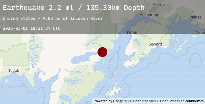
A 2.2 magnitude earthquake struck on 32 km E of Pedro Bay, Alaska, at Thu, 01 Jan 2026 18:21:37 GMT. Depth: 135.3km. Reviewed by USGS seismologists, this minor quake occurred at a magnitude type of ml.
Magnitude
2.2
ml
Source
USGS
Intensity
-
Agency Reports
1 Sources| Source | Magnitude | Depth | Time |
|---|---|---|---|
| USGSPrimary | 2.2 | 135 km | 2 hours ago |
Earthquake Details
AutomaticEvent IDusgs_ak2026abknkj
Tsunami PotentialNo
Magnitude Typeml
Nearest Places
- Iniskin River4.1 km
- Sugarloaf Mountain4.2 km
- Roscoe Peak5.9 km
- Mount Eleanor8.9 km
- Range Peak9.8 km
Comments
Join the discussion about this event.
Latest Earthquakes
3.0Mag
Halmahera, Indonesia
Time2 hours ago
Depth110.74 km
SourceBMKG (Automatic)
2.3Mag
NEAR THE COAST OF SYRIA
Time2 hours ago
Depth7.50 km
SourceKOERI (Automatic)
1.9Mag
WESTERN TURKEY
Time2 hours ago
Depth11.60 km
SourceEMSC (Automatic)
1.6Mag
STRAIT OF GIBRALTAR
Time2 hours ago
Depth33.50 km
SourceIGN (Automatic)
2.3Mag
West Papua Region, Indonesia
Time2 hours ago
Depth15.99 km
SourceBMKG (Automatic)
Nearby Earthquakes
2.2Mag
56 km WNW of Nanwalek, Alaska
Time4 hours ago
Depth89.70 km
SourceUSGS (Automatic)
2.2Mag
24 km SW of Anchor Point, Alaska
Time7 hours ago
Depth62.20 km
SourceUSGS (Automatic)
2.8Mag
33 km SW of Nanwalek, Alaska
Time10 hours ago
Depth62.90 km
SourceUSGS (Automatic)
2.1Mag
60 km ENE of Pedro Bay, Alaska
Time10 hours ago
Depth127.30 km
SourceUSGS (Automatic)
1.9Mag
43 km WSW of Anchor Point, Alaska
Time19 hours ago
Depth71.10 km
SourceUSGS (Automatic)