Earthquake 34 km N of Chase, Alaska
Mon, 12 Jan 2026 18:37:27 GMT
Time6 hours ago
Location
62.7610, -150.1620
Depth
72.8 KM
Event Summary
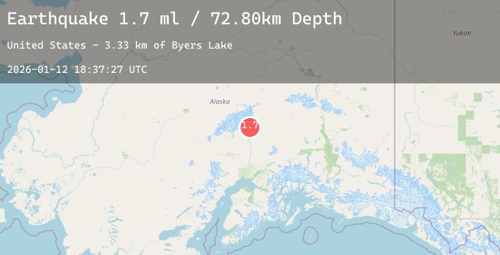
A 2.0 magnitude earthquake struck on 34 km N of Chase, Alaska, at Mon, 12 Jan 2026 18:37:27 GMT. Depth: 72.8km. Reviewed by USGS seismologists, this minor quake occurred at a magnitude type of ml.
Magnitude
2.0
ml
Source
USGS
Intensity
-
Agency Reports
2 Sources| Source | Magnitude | Depth | Time |
|---|---|---|---|
| USGSPrimary | 1.7 | 73 km | 6 hours ago |
| USGSPrimary | 2.0 | 1 km | 6 hours ago |
Earthquake Details
AutomaticEvent IDusgs_ak2026avqaqd
Tsunami PotentialNo
Magnitude Typeml
Nearest Places
- Byers Lake3.3 km
- Spink Lake4.6 km
- Fountain River5.4 km
- Spink Creek5.5 km
- Byers Creek5.6 km
Comments
Join the discussion about this event.
Latest Earthquakes
1.5Mag
8 km NW of Pinnacles, CA
Time6 hours ago
Depth7.22 km
SourceUSGS (Automatic)
4.0Mag
Northern Sumatra, Indonesia
Time6 hours ago
Depth5.86 km
SourceBMKG (Automatic)
0.9Mag
6 km NW of The Geysers, CA
Time6 hours ago
Depth2.61 km
SourceUSGS (Automatic)
2.7Mag
Northern Sumatra, Indonesia
Time6 hours ago
Depth14.75 km
SourceBMKG (Automatic)
1.5Mag
36 km NW of Ninilchik, Alaska
Time6 hours ago
Depth87.70 km
SourceUSGS (Automatic)
Nearby Earthquakes
2.2Mag
48 km NNE of Chase, Alaska
Time15 hours ago
Depth71.40 km
SourceUSGS (Automatic)
1.6Mag
23 km ESE of Denali National Park, Alaska
Time16 hours ago
Depth2.90 km
SourceUSGS (Automatic)
1.8Mag
9 km NNW of Trapper Creek, Alaska
Time19 hours ago
Depth5.70 km
SourceUSGS (Automatic)
1.9Mag
45 km WNW of Cantwell, Alaska
Time19 hours ago
Depth104.00 km
SourceUSGS (Automatic)
1.7Mag
19 km WSW of Petersville, Alaska
Time1 day ago
Depth85.30 km
SourceUSGS (Automatic)