Earthquake 31 km W of Nanwalek, Alaska
Thu, 15 Jan 2026 06:49:01 GMT
Time9 hours ago
Location
59.3250, -152.4740
Depth
72.3 KM
Event Summary
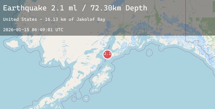
A 2.1 magnitude earthquake struck on 31 km W of Nanwalek, Alaska, at Thu, 15 Jan 2026 06:49:01 GMT. Depth: 72.3km. Reviewed by USGS seismologists, this minor quake occurred at a magnitude type of ml.
Magnitude
2.1
ml
Source
USGS
Intensity
-
Agency Reports
1 Sources| Source | Magnitude | Depth | Time |
|---|---|---|---|
| USGSPrimary | 2.1 | 72 km | 9 hours ago |
Earthquake Details
AutomaticEvent IDusgs_ak2026bafsun
Tsunami PotentialNo
Magnitude Typeml
Nearest Places
- Jakolof Bay16.1 km
- Magnet Rock26.7 km
- Cook Inlet27.0 km
- Flat Island Light27.2 km
- Flat Islands27.3 km
Comments
Join the discussion about this event.
Latest Earthquakes
0.5Mag
8 km NW of The Geysers, CA
Time9 hours ago
Depth1.96 km
SourceUSGS (Automatic)
2.1Mag
Flores Sea
Time9 hours ago
Depth17.96 km
SourceBMKG (Automatic)
3.6Mag
ECUADOR
Time9 hours ago
Depth95.00 km
SourceQUI (Automatic)
3.1Mag
NORTHERN ALGERIA
Time9 hours ago
Depth0.00 km
SourceIGN (Automatic)
3.7Mag
47 km SW of Skwentna, Alaska
Time10 hours ago
Depth101.20 km
SourceUSGS
Nearby Earthquakes
1.9Mag
50 km ESE of Pedro Bay, Alaska
Time11 hours ago
Depth106.20 km
SourceUSGS (Automatic)
2.2Mag
32 km WNW of Ninilchik, Alaska
Time13 hours ago
Depth73.90 km
SourceUSGS (Automatic)
2.6Mag
42 km ENE of Pedro Bay, Alaska
Time16 hours ago
Depth136.90 km
SourceUSGS (Automatic)
1.7Mag
10 km W of Ninilchik, Alaska
Time18 hours ago
Depth67.00 km
SourceUSGS (Automatic)
2.2Mag
53 km WNW of Nanwalek, Alaska
Time21 hours ago
Depth95.80 km
SourceUSGS (Automatic)