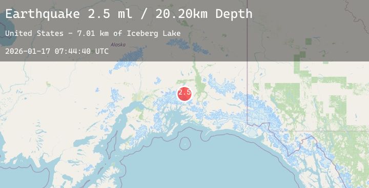
Earthquake 44 km N of Valdez, Alaska
Sat, 17 Jan 2026 07:44:40 GMT
Time4 hours ago
Location
61.5310, -146.3760
Depth
5.2 KM
Event Summary
A 2.3 magnitude earthquake struck on 44 km N of Valdez, Alaska, at Sat, 17 Jan 2026 07:44:40 GMT. Depth: 5.2km. Reviewed by USGS seismologists, this minor quake occurred at a magnitude type of ml.
Magnitude
2.3
ml
Source
USGS
Intensity
-
Agency Reports
1 Sources| Source | Magnitude | Depth | Time |
|---|---|---|---|
| USGSPrimary | 2.3 | 5 km | 4 hours ago |
Earthquake Details
AutomaticEvent IDusgs_ak2026bdzane
Tsunami PotentialNo
Magnitude Typeml
Nearest Places
- Iceberg Lake8.8 km
- Tazlina Glacier13.5 km
- Terrace Mountain15.1 km
- Garrett Peak15.4 km
- Brontosaurus Mountain16.6 km
Comments
Join the discussion about this event.
Latest Earthquakes
1.6Mag
14 km NNE of Sutton-Alpine, Alaska
Time4 hours ago
Depth27.20 km
SourceUSGS (Automatic)
2.0Mag
Northern Sumatra, Indonesia
Time4 hours ago
Depth38.97 km
SourceBMKG (Automatic)
1.2Mag
16 km S of Tres Pinos, CA
Time4 hours ago
Depth4.69 km
SourceUSGS (Automatic)
1.5Mag
5 km SSW of Idyllwild, CA
Time4 hours ago
Depth17.31 km
SourceUSGS (Automatic)
2.6Mag
Seram, Indonesia
Time4 hours ago
Depth27.99 km
SourceBMKG (Automatic)