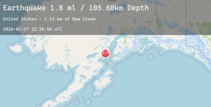
Earthquake 58 km E of Pedro Bay, Alaska
Sat, 17 Jan 2026 22:36:57 GMT
Time1 hour ago
Location
59.7250, -153.0690
Depth
101.9 KM
Event Summary
A 2.3 magnitude earthquake struck on 58 km E of Pedro Bay, Alaska, at Sat, 17 Jan 2026 22:36:57 GMT. Depth: 101.9km. Reviewed by USGS seismologists, this minor quake occurred at a magnitude type of ml.
Magnitude
2.3
ml
Source
USGS
Intensity
-
Agency Reports
1 Sources| Source | Magnitude | Depth | Time |
|---|---|---|---|
| USGSPrimary | 2.3 | 102 km | 1 hour ago |
Earthquake Details
AutomaticEvent IDusgs_ak2026bfcpki
Tsunami PotentialNo
Magnitude Typeml
Nearest Places
- Bow Creek2.5 km
- Cirque Creek3.0 km
- Chinitna Point3.7 km
- South Chinitna Mountain4.5 km
- Rich Creek4.8 km
Comments
Join the discussion about this event.
Latest Earthquakes
1.3Mag
24 km SSE of Lindsay, Texas
Time4 minutes ago
Depth8.96 km
SourceUSGS (Automatic)
3.2Mag
Northern Sumatra, Indonesia
Time5 minutes ago
Depth161.92 km
SourceBMKG (Automatic)
3.2Mag
ISLAND OF HAWAII, HAWAII
Time17 minutes ago
Depth22.20 km
SourceNEIC (Automatic)
2.6Mag
Java, Indonesia
Time21 minutes ago
Depth75.88 km
SourceBMKG (Automatic)
1.2Mag
5 km S of Parkfield, CA
Time23 minutes ago
Depth5.93 km
SourceUSGS (Automatic)
Nearby Earthquakes
2.3Mag
45 km WSW of Nanwalek, Alaska
Time9 hours ago
Depth70.00 km
SourceUSGS (Automatic)
1.7Mag
51 km WNW of Nanwalek, Alaska
Time11 hours ago
Depth76.50 km
SourceUSGS (Automatic)
1.9Mag
26 km SSE of Pope-Vannoy Landing, Alaska
Time18 hours ago
Depth4.30 km
SourceUSGS
2.2Mag
49 km W of Anchor Point, Alaska
Time21 hours ago
Depth89.50 km
SourceUSGS (Automatic)