Earthquake 22 km N of Karluk, Alaska
Thu, 22 Jan 2026 22:12:01 GMT
Time6 days ago
Location
57.7710, -154.3830
Depth
51.4 KM
Event Summary
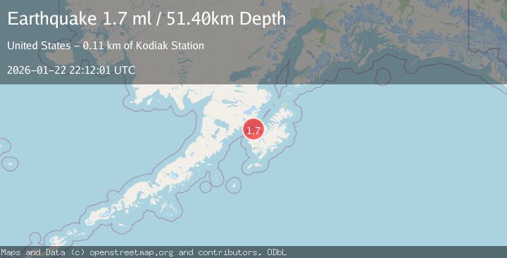
A 1.7 magnitude earthquake struck on 22 km N of Karluk, Alaska, at Thu, 22 Jan 2026 22:12:01 GMT. Depth: 51.4km. Reviewed by USGS seismologists, this minor quake occurred at a magnitude type of ml.
Magnitude
1.7
ml
Source
USGS
Intensity
-
Agency Reports
1 Sources| Source | Magnitude | Depth | Time |
|---|---|---|---|
| USGSPrimary | 1.7 | 51 km | 6 days ago |
Earthquake Details
AutomaticEvent IDusgs_ak2026bogkhy
Tsunami PotentialNo
Magnitude Typeml
Nearest Places
- Shelikhov Strait12.6 km
- Cape Uyak14.9 km
- Rocky Point14.9 km
- Wolcott Reef15.8 km
- Northeast Harbor16.1 km
Comments
Join the discussion about this event.
Latest Earthquakes
1.9Mag
NORTHERN ITALY
Time2 hours ago
Depth1.00 km
SourceLDG (Automatic)
3.4Mag
Minahassa Peninsula, Sulawesi
Time2 hours ago
Depth15.68 km
SourceBMKG (Automatic)
3.2Mag
COSTA RICA
Time2 hours ago
Depth39.00 km
SourceINET (Automatic)
1.2Mag
15 km W of Johannesburg, CA
Time2 hours ago
Depth5.56 km
SourceUSGS (Automatic)
1.0Mag
8 km WNW of Cobb, CA
Time2 hours ago
Depth1.94 km
SourceUSGS (Automatic)
Nearby Earthquakes
2.2Mag
15 km W of Karluk, Alaska
Time3 days ago
Depth22.10 km
SourceUSGS (Automatic)
1.5Mag
61 km N of Karluk, Alaska
Time2 days ago
Depth83.80 km
SourceUSGS (Automatic)
1.3Mag
60 km NNW of Karluk, Alaska
Time2 days ago
Depth5.00 km
SourceUSGS (Automatic)
2.6Mag
KODIAK ISLAND REGION, ALASKA
Time5 hours ago
Depth20.30 km
SourceAK (Automatic)
0.9Mag
79 km NNW of Karluk, Alaska
Time2 days ago
Depth5.00 km
SourceUSGS (Automatic)