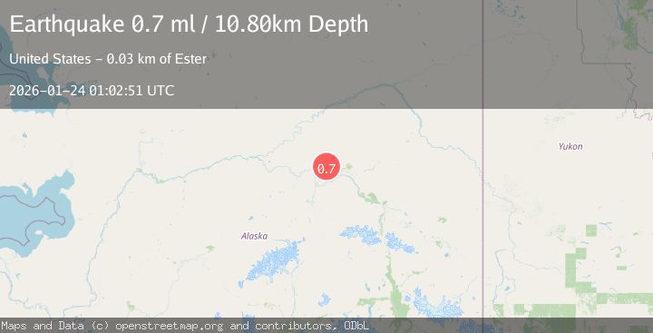
Earthquake 28 km WNW of Ester, Alaska
Sat, 24 Jan 2026 01:02:51 GMT
Time3 days ago
Location
64.9620, -148.5560
Depth
10.8 KM
Event Summary
A 0.7 magnitude earthquake struck on 28 km WNW of Ester, Alaska, at Sat, 24 Jan 2026 01:02:51 GMT. Depth: 10.8km. Reviewed by USGS seismologists, this minor quake occurred at a magnitude type of ml.
Magnitude
0.7
ml
Source
USGS
Intensity
-
Agency Reports
1 Sources| Source | Magnitude | Depth | Time |
|---|---|---|---|
| USGSPrimary | 0.7 | 11 km | 3 days ago |
Earthquake Details
AutomaticEvent IDusgs_ak2026bqhukt
Tsunami PotentialNo
Magnitude Typeml
Nearest Places
- Hard Luck Creek3.1 km
- Murphy Dome Air Force Station9.3 km
- Murphy Dome9.6 km
- Shovel Creek10.2 km
- Dawson Creek10.9 km
Comments
Join the discussion about this event.
Latest Earthquakes
3.7Mag
VALPARAISO, CHILE
Time6 minutes ago
Depth27.60 km
SourceCSN (Automatic)
2.0Mag
CENTRAL TURKEY
Time9 minutes ago
Depth23.50 km
SourceKOERI (Automatic)
3.2Mag
OFFSHORE EL SALVADOR
Time10 minutes ago
Depth28.00 km
SourceINET (Automatic)
3.1Mag
South of Java, Indonesia
Time11 minutes ago
Depth5.01 km
SourceBMKG (Automatic)
2.2Mag
Near North Coast of West Papua
Time14 minutes ago
Depth10.00 km
SourceBMKG (Automatic)
Nearby Earthquakes
0.6Mag
31 km ESE of Minto, Alaska
Time1 day ago
Depth9.80 km
SourceUSGS (Automatic)
1.6Mag
29 km SE of Minto, Alaska
Time1 day ago
Depth23.20 km
SourceUSGS (Automatic)
1.7Mag
18 km WSW of Ester, Alaska
Time2 days ago
Depth6.50 km
SourceUSGS (Automatic)
0.7Mag
22 km NE of Four Mile Road, Alaska
Time4 hours ago
Depth28.90 km
SourceUSGS (Automatic)
1.0Mag
28 km SSW of Livengood, Alaska
Time3 days ago
Depth5.00 km
SourceUSGS (Automatic)