Earthquake 7 km NW of Point MacKenzie, Alaska
Mon, 26 Jan 2026 13:20:58 GMT
Time23 hours ago
Location
61.4010, -150.0980
Depth
32.7 KM
Event Summary
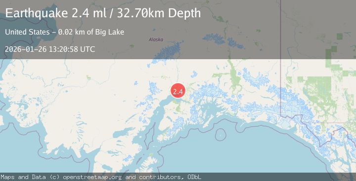
A 2.4 magnitude earthquake struck on 7 km NW of Point MacKenzie, Alaska, at Mon, 26 Jan 2026 13:20:58 GMT. Depth: 32.7km. Reviewed by USGS seismologists, this minor quake occurred at a magnitude type of ml.
Magnitude
2.4
ml
Source
USGS
Intensity
-
Agency Reports
1 Sources| Source | Magnitude | Depth | Time |
|---|---|---|---|
| USGSPrimary | 2.4 | 33 km | 23 hours ago |
Earthquake Details
AutomaticEvent IDusgs_ak2026buxsfm
Tsunami PotentialNo
Magnitude Typeml
Nearest Places
- Point MacKenzie Correctional Farm2.1 km
- Robin's Landing Airport2.8 km
- Butterfly Lake2.8 km
- Farmer Lake3.0 km
- Point Mac Airport3.8 km
Comments
Join the discussion about this event.
Latest Earthquakes
2.5Mag
SOUTHERN ALASKA
Time23 hours ago
Depth72.00 km
SourceAK (Automatic)
5.1Mag
50 km SE of ‘Ohonua, Tonga
Time23 hours ago
Depth10.00 km
SourceUSGS
1.0Mag
127 km NW of Yakutat, Alaska
Time23 hours ago
Depth19.90 km
SourceUSGS (Automatic)
2.0Mag
WESTERN TURKEY
Time23 hours ago
Depth14.60 km
SourceEMSC (Automatic)
2.6Mag
Minahassa Peninsula, Sulawesi
Time23 hours ago
Depth2.18 km
SourceBMKG (Automatic)
Nearby Earthquakes
1.4Mag
2 km SW of Big Lake, Alaska
Time3 days ago
Depth38.00 km
SourceUSGS (Automatic)
1.7Mag
3 km SW of Houston, Alaska
Time4 days ago
Depth58.40 km
SourceUSGS (Automatic)
2.6Mag
7 km S of Willow, Alaska
Time1 day ago
Depth5.00 km
SourceUSGS (Automatic)
1.5Mag
7 km S of Willow, Alaska
Time2 days ago
Depth10.10 km
SourceUSGS (Automatic)
2.5Mag
5 km SE of Elmendorf Air Force Base, Alaska
Time3 days ago
Depth39.60 km
SourceUSGS (Automatic)