Earthquake 52 km S of Glacier View, Alaska
Tue, 27 Jan 2026 15:10:39 GMT
Time1 hour ago
Location
61.3370, -147.7440
Depth
5.0 KM
Event Summary
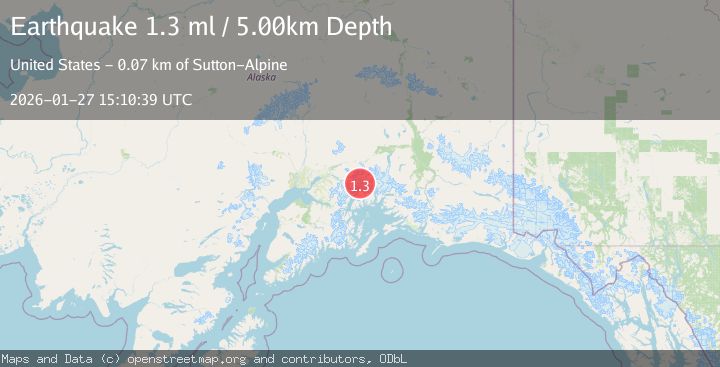
A 1.3 magnitude earthquake struck on 52 km S of Glacier View, Alaska, at Tue, 27 Jan 2026 15:10:39 GMT. Depth: 5km. Reviewed by USGS seismologists, this minor quake occurred at a magnitude type of ml.
Magnitude
1.3
ml
Source
USGS
Intensity
-
Agency Reports
1 Sources| Source | Magnitude | Depth | Time |
|---|---|---|---|
| USGSPrimary | 1.3 | 5 km | 1 hour ago |
Earthquake Details
AutomaticEvent IDusgs_ak2026bwxbpn
Tsunami PotentialNo
Magnitude Typeml
Nearest Places
- Radcliffe Glacier2.4 km
- Baltimore Glacier4.2 km
- Harvard Glacier5.3 km
- Eliot Glacier6.3 km
- Smith Glacier6.6 km
Comments
Join the discussion about this event.
Latest Earthquakes
3.4Mag
Banda Sea
Time8 minutes ago
Depth159.46 km
SourceBMKG (Automatic)
2.3Mag
SICILY, ITALY
Time12 minutes ago
Depth7.70 km
SourceINGV (Automatic)
3.2Mag
Talaud Islands, Indonesia
Time13 minutes ago
Depth32.03 km
SourceBMKG (Automatic)
3.4Mag
BAJA CALIFORNIA, MEXICO
Time15 minutes ago
Depth20.40 km
SourceSCSN (Automatic)
3.4Mag
Southwest of Sumatra, Indonesia
Time16 minutes ago
Depth10.00 km
SourceBMKG (Automatic)
Nearby Earthquakes
1.0Mag
61 km NE of Whittier, Alaska
Time4 days ago
Depth46.70 km
SourceUSGS (Automatic)
1.6Mag
54 km NE of Whittier, Alaska
Time3 days ago
Depth5.00 km
SourceUSGS (Automatic)
1.5Mag
52 km WNW of Tatitlek, Alaska
Time4 days ago
Depth7.30 km
SourceUSGS (Automatic)
1.3Mag
47 km WNW of Tatitlek, Alaska
Time3 days ago
Depth5.00 km
SourceUSGS (Automatic)
3.5Mag
45 km NW of Tatitlek, Alaska
Time6 hours ago
Depth13.60 km
SourceUSGS (Automatic)