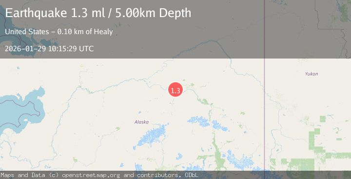
Earthquake 20 km NNE of Four Mile Road, Alaska
Thu, 29 Jan 2026 10:15:29 GMT
Time4 hours ago
Location
64.7770, -148.9780
Depth
5.0 KM
Event Summary
A 1.3 magnitude earthquake struck on 20 km NNE of Four Mile Road, Alaska, at Thu, 29 Jan 2026 10:15:29 GMT. Depth: 5km. Reviewed by USGS seismologists, this minor quake occurred at a magnitude type of ml.
Magnitude
1.3
ml
Source
USGS
Intensity
-
Agency Reports
1 Sources| Source | Magnitude | Depth | Time |
|---|---|---|---|
| USGSPrimary | 1.3 | 5 km | 4 hours ago |
Earthquake Details
AutomaticEvent IDusgs_ak2026caetam
Tsunami PotentialNo
Magnitude Typeml
Nearest Places
- Little Goldstream Creek4.4 km
- Bridge Lake6.3 km
- Twomile Lake7.3 km
- Dunbar9.1 km
- Sawmill Island9.4 km
Comments
Join the discussion about this event.
Latest Earthquakes
2.4Mag
Minahassa Peninsula, Sulawesi
Time3 minutes ago
Depth41.66 km
SourceBMKG (Automatic)
1.1Mag
5 km W of Cobb, CA
Time6 minutes ago
Depth1.84 km
SourceUSGS (Automatic)
2.3Mag
Sumbawa Region, Indonesia
Time7 minutes ago
Depth24.84 km
SourceBMKG (Automatic)
1.6Mag
7 km NNE of Coso Junction, CA
Time13 minutes ago
Depth3.84 km
SourceUSGS (Automatic)
1.8Mag
22 km SSE of Eureka Roadhouse, Alaska
Time18 minutes ago
Depth35.50 km
SourceUSGS (Automatic)
Nearby Earthquakes
0.7Mag
22 km NE of Four Mile Road, Alaska
Time2 days ago
Depth28.90 km
SourceUSGS (Automatic)
2.2Mag
8 km N of Four Mile Road, Alaska
Time3 days ago
Depth19.90 km
SourceUSGS (Automatic)
0.8Mag
14 km NNW of Four Mile Road, Alaska
Time14 hours ago
Depth19.30 km
SourceUSGS (Automatic)
1.6Mag
29 km SE of Minto, Alaska
Time3 days ago
Depth23.20 km
SourceUSGS (Automatic)
0.6Mag
31 km ESE of Minto, Alaska
Time3 days ago
Depth9.80 km
SourceUSGS (Automatic)